
Country United States FIPS code 47-13020 Elevation 222 m Local time Friday 7:53 AM Area code 423 | State Tennessee Time zone Eastern (EST) (UTC-5) GNIS feature ID 1305866 Zip code 37310 Population 665 (2013) | |
 | ||
Weather -1°C, Wind SE at 0 km/h, 91% Humidity Area 259 ha (259 ha Land / 26 ha Water) | ||
Charleston is a city in Bradley County, Tennessee, United States. The population was 651 at the 2010 census. It is included in the Cleveland Metropolitan Statistical Area.
Contents
Map of Charleston, TN, USA
History
Charleston was the site of the last Cherokee Agency as well as Fort Cass, the headquarters of the Cherokee Removal of 1838, known as the Trail of Tears. The valley between Charleston and Cleveland, Tennessee was filled for 12 miles (19 km) with internment camps in which thousands of Cherokee from various towns waited during the summer of 1838 for the start of the main trek west (Duncan 2003:261).
Geography
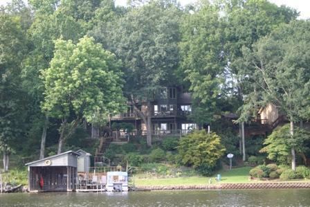
Charleston is situated along the south bank of the Hiwassee River, which flows down out of the Appalachian Mountains several miles to the east and empties into the Chickamauga Lake impoundment of the Tennessee River several miles to the west. The river forms the boundary between Bradley County and McMinn County. Calhoun, Charleston's sister city, is situated on the north bank of the Hiwassee, on the McMinn County side.
Charleston is traversed by U.S. Route 11, which enters the city from Calhoun to the north and exits the city en route to Cleveland to the south. Interstate 75, which roughly parallels U.S. 11 in the area, runs along Charleston's western boundary.
According to the United States Census Bureau, the city has a total area of 1.0 square mile (2.6 km2), of which 0.1 square miles (0.26 km2), or 5.77%, is water.
Demographics
As of the census of 2000, there were 630 people, 265 households, and 182 families residing in the city. The population density was 639.9 people per square mile (248.2/km²). There were 280 housing units at an average density of 284.4 per square mile (110.3/km²). The racial makeup of the city was 72.54% White, 23.49% African American, 0.48% Asian, 0.79% from other races, and 2.70% from two or more races. Hispanic or Latino of any race were 1.90% of the population.
There were 265 households out of which 24.9% had children under the age of 18 living with them, 56.2% were married couples living together, 9.8% had a female householder with no husband present, and 31.3% were non-families. 29.1% of all households were made up of individuals and 12.5% had someone living alone who was 65 years of age or older. The average household size was 2.38 and the average family size was 2.92.
In the city, the population was spread out with 22.5% under the age of 18, 8.3% from 18 to 24, 26.7% from 25 to 44, 26.8% from 45 to 64, and 15.7% who were 65 years of age or older. The median age was 39 years. For every 100 females there were 91.5 males. For every 100 females age 18 and over, there were 88.4 males.
The median income for a household in the city was $33,750, and the median income for a family was $40,781. Males had a median income of $31,389 versus $18,333 for females. The per capita income for the city was $18,586. About 5.7% of families and 8.6% of the population were below the poverty line, including 14.0% of those under age 18 and 12.9% of those age 65 or over.
Economy
The city is across the Hiwassee River from a large paper mill operation of Bowater Corporation (Resolute Forrest Products) in Calhoun, which is a major local employer. Logging trucks and rail traffic to and from this plant frequently traverse Charleston.
Germany based chemical company Wacker Chemie broke ground in 2011 on a new solar-grade polysilicon production facility (550-acre Greenfield site). At a cost of $ 2 billion there will be 650 new jobs generated.
Charleston is the postal address of the international headquarters of the Christian denomination The Church of God, commonly called "The Church of God (Charleston, Tennessee)" to distinguish it from other similarly named denominations. However, the denomination's headquarters are actually located in Cleveland.
An Amazon Fulfillment Center, located off the interstate in Charleston, employs several hundred people.
Olin Chemical and Lonza, both located on Old Lower River Road in Charleston, make pool chemicals as well as several other products. They employ several hundred people.
Climate
The climate in this area is characterized by hot, humid summers and generally mild to cool winters. According to the Köppen Climate Classification system, Charleston has a humid subtropical climate, abbreviated "Cfa" on climate maps.