
OS grid reference SU310561 Dialling code 01264 | Sovereign state United Kingdom Postcode district SN8 UK parliament constituency Devizes | |
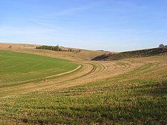 | ||
Hippenscombe is a small settlement within the civil parish of Tidcombe and Fosbury, Wiltshire, in the southwest of England. Marked only on large-scale maps, its location is to the southwest of Oakhill Wood and the northwest of Conholt Park, about 8 miles (13 km) south of Hungerford, Berkshire.
Hippenscombe has a long separate history of its own, having been an extra-parochial area. It was severely affected by the Swing Riots of 1830.
John Marius Wilson's Imperial Gazetteer of England and Wales (1870-1872) said of Hippenscombe:
HIPPENSCOMBE, an extra-parochial tract in the district of Hungerford and county of Wilts; adjacent to Hants and Berks, 4¼ miles NE of Ludgershall. Acres, 980. Real property, £545. Pop., 42. Houses, 11.
It was incorporated into Tidcombe in 1879.