Neha Patil (Editor)

Southwest Hills, Portland, Oregon

Updated on
Edit
Like
Comment
Share on FacebookTweet on TwitterShare on LinkedInShare on Reddit
Country
  
United States

City
  
Portland

Number of households
  
1,992

State
  
Oregon

Area
  
5.309 km²

Southwest Hills, Portland, Oregon httpswwwmovingtoportlandnetwpcontentupload

Restaurants
  
Vista Spring Cafe, Classic Ranch, LLC, Rock Creek Cafe & Pub

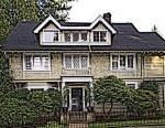
Southwest Hills is a neighborhood in the West Hills (Tualatin Mountains) in the southwest section of Portland, Oregon, United States. The northeastern part of the neighborhood, above Goose Hollow and Downtown Portland, is known as Portland Heights. Much of the western portion of the neighborhood lies outside the Portland city limits, in unincorporated Multnomah County.

Contents

Map of Southwest Hills, Portland, OR, USA

Neighborhood landmarks include Council Crest Park and Ainsworth Elementary School.

Parks

  • Council Crest Park - SW Council Crest Dr.
  • Governors Park - SW 13th Ave & Davenport St.
  • Marquam Nature Park - SW Marquam St & Sam Jackson Park Rd.
  • Norris House & Property - 4455 SW Terwilliger Blvd.
  • Portland Heights Park - SW Patton Rd. & Old Orchard Rd.
  • Coordinates

  • Portland Heights is located at 45.5056737°N 122.7031520°W / 45.5056737; -122.7031520 (Portland Heights)
  • Council Crest is located at 45.499007°N 122.705652°W / 45.499007; -122.705652 (Council Crest)
  • References

    Southwest Hills, Portland, Oregon Wikipedia