
OS grid NS273630 Elevation 522 m | Topo map OS Landranger 63 Listing Marilyn | |
 | ||
Similar Culter Fell, Kirriereoch Hill, Broad Law, Cold Overton Park, Cheeks Hill | ||
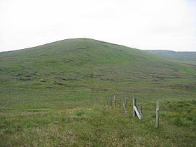
Hill of Stake is a hill on the boundary between North Ayrshire and Renfrewshire, Scotland. It is 522 metres (1712 feet) high. It is one of the Marilyns of Lowland Scotland.
Map of Hill of Stake, Lochwinnoch, UK
It is the highest point of the relatively low-lying county of Renfrewshire and indeed the entire Clyde Muirshiel Regional Park of which it is a part.
References
Hill of Stake Wikipedia(Text) CC BY-SA