
Population 464 2011 Census Sovereign state United Kingdom | Civil parish Hessett | |
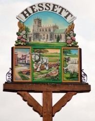 | ||
Belocal the five bells hessett
Hessett is a village and civil parish in the Mid Suffolk district of Suffolk in eastern England. Located around four miles south east of Bury St Edmunds, in 2005 its population was 490. Hessett is south of Beyton and west of Drinkstone.
Contents
Map of Hessett, Bury Saint Edmunds, UK
In 1870's, John Marius Wilson's (Imperial Gazetteer of England and Wales) described Hessett like this:
HESSETT, a parish in Stow district, Suffolk; 2½ miles S of Thurston r. station. The church was built by the Bacons; is in good condition; has a beautiful window and a tower; and contains tombs of the Bacons.
History
The small village has been present in this area for over "1000 years with the earliest mention was in AD 1005 when Ulfketel gave the village (alongside others) to Abbey Bury, St. Edmund's." According to the 2011 Census there were 216 males and 248 females living in the parish.
From the population time series created using data from the Neighbourhood Statistics website the graph shows some considerable decline in the population from 1850 until approximately the 1970's where there has been a considerable incline in the population for Hessett. This data could coincide with certain points in history which would mark the decline in population in the early 1900's where many of the men would have been sent to war- many of whom would not have returned and with this incline during the 1970's as a result of the introductions of the NHS and the modern medicine this brought to save lives.
The 1945 map of Hessett retrieved from Vision of Britain shows the extent of the area of Hessett. It is a very small village with the heart of the village being The Green which is a small area of grass. The boundary of the 1945 map includes the Monk Wood and some part of the Drinkstone Park but not all.
From the graph showing Occupations for male and females in 1881 for Hessett it is dominated by agricultural based occupations with much reference to men only- at this stage in history it was common for women to lead a more domestic life in working at home. This vast majority of the population working in this area in 1881 suggests that Hessett was quite a remote place made up of farms and fields.
From the current key statistics of the 2011 census report it showed the ratio of male to female residents in Hessett with a total population of 464 residents- 216 being male and 248 female.
Church
According to the work taken out by Simon Knott his research over the past 10 years has contributed hugely to the history of the Church of St. Ethelbert whereby he acknowledges the "typical Suffolk perpendicular church of the 15th century" along with a mention of the typical features found in the Church of St. Ethelbert including "the chancel is separated from the nave by the 15th century rood screen, which is elegantly painted and gilt on the west side". There was a period in 1969 whereby Mrs. Mary Moss claimed Reverend Kenneth Matthews managed to cure her condition of being unable to walk when the Reverend "put his hands on her head and told her to get up from the wheelchair" which led to masses amount of people traveled to the Church in order to receive the same magical treatment for their conditions.