
Country United States County Fulton GNIS feature ID 453406 Local time Thursday 6:08 PM | State Indiana FIPS code 18-33106 Elevation 254 m Population 3,048 (2010) | |
 | ||
Weather 6°C, Wind N at 16 km/h, 44% Humidity Area 121.1 km² (120.3 km² Land / 78 ha Water) | ||
Henry Township is one of eight townships in Fulton County, Indiana. As of the 2010 census, its population was 3,048 and it contained 1,224 housing units.
Contents
- Map of Henry Township IN USA
- History
- Geography
- Cities and towns
- Unincorporated towns
- Adjacent townships
- Major highways
- Cemeteries
- References
Map of Henry Township, IN, USA
History
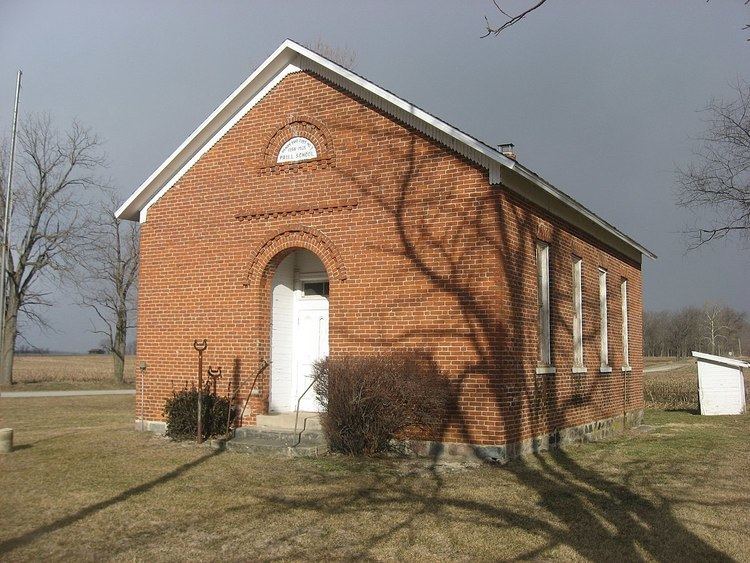
The Prill School and Utter-Gerig Round Barn are listed on the National Register of Historic Places.
Geography
According to the 2010 census, the township has a total area of 46.75 square miles (121.1 km2), of which 46.45 square miles (120.3 km2) (or 99.36%) is land and 0.3 square miles (0.78 km2) (or 0.64%) is water.
Cities and towns
Unincorporated towns
Adjacent townships
Major highways
Cemeteries
The township contains two cemeteries: Independent Order of Odd Fellows and Mount Hope Athens.
References
Henry Township, Fulton County, Indiana Wikipedia(Text) CC BY-SA