
 | ||
Location Cowal, Argyll and Bute, Scotland. | ||
Drive across hell s glen
Hell's Glen is a glen on the Cowal Peninsula, in the Arrochar Alps between the mountains Cruach nam Mult and Stob an Eas. To the west, it leads to Loch Fyne and to the east, the high mountain Ben Donich. The glen is within the Argyll Forest Park that is itself within the Loch Lomond and The Trossachs National Park.
Contents
Map of Hells Glen, Cairndow, UK
The glen is named from its name in Gaelic, Glen Iarainn. This actually means the Iron Glen but sounds like the nearby Glen Ifhrinn which really means the Glen of Hell. The glen is also known as Scottish Gaelic: An Gleann Beag, "the small glen".
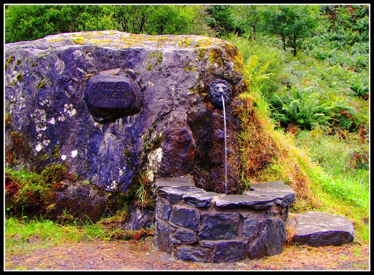
Moses' Well
On the south-west side of the glen is a jumble of rocks. In the 19th century, a local minister constructed a spring in one of the rocks which was named after the incident in Exodus:
This then became a stop at which coaching horses would drink.