
Demonym(s) Hattemer Postcode 8050–8052 Area 24.2 km² Local time Saturday 3:02 AM | Elevation 5 m (16 ft) Time zone CET (UTC+1) Website www.hattem.nl Area code 038 | |
 | ||
Weather 8°C, Wind SW at 31 km/h, 94% Humidity Points of interest Nederlands Bakkerijmuseum, Anton Pieck Museum, Voerman Museum Hattem | ||
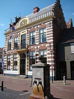
Hattem ( pronunciation ) is a municipality and a city in the eastern Netherlands. The municipality had a population of 11,739 in 2014. The municipality includes the hamlet of 't Zand.
Contents
- Map of Hattem Netherlands
- Name origin
- History
- Established as parish
- Later history
- Other information
- Notable residents
- Sightseeing
- References
Map of Hattem, Netherlands
Name origin
The name “Hattem” is a typical farmyard name. The exact origin of “Hattem” is yet unclear. In general two explanation exist. Hattem would be the ‘heem’ (home) of a people who belong to the tribe of Chattuarii (or Hattuarii or Hatten). A second origin could refer to the leader of a people under the leader Hatto. This fits with the fact that a lot of farmyard names are deduced from persons names.
History
A document referring to Hattem is found is dated around 800. This document is the Codex Laureshamensis, in which the settlement Hattem is mentioned because two farmhouses in this place are donated to the Lorsch abbey.
Established as parish
Despite this early statement, no church or chapel was built in Hattem. In 1176 Hattem became a parish (‘kerspel’). The chapel, measuring 17,5 by 9,5 meter, was not built at the current city centre, but at the Gaedsberg (‘Gods-mountain’). The borders of the parish coincide with the latter borders of the jurisdiction Hattem. Hattem obtained city rights in 1299 from the landgrave Reinoud I van Gelre. In the decades before a fortified town is founded at the northern border of the Veluwe. The city plan lies around the current church. The tower of this church is dated to the 12th century which indicates that, beside the parish church at the Gaedsberg, a chapel was present at the current city centre of Hattem. With obtaining town privileges, both the religious and the legal centre were moved. The new church and the city are dedicated to the apostle Andreas.
Later history
In 1401, duke William of Guelders donated the Hoenwaard to the citizens of Hattem, in order to feed their cattle and to manufacture bricks for their houses. In 1404 the castle St. Lucia was built, which became known as the “Dikke Tinne” (the fat merlon). The reason can be found in the thick castle walls, at that time the thickest walls found in the Netherlands. In 1778, the castle was torn down, in order to use the bricks to build houses. In 1786, both Hattem and Elburg became known as centres of the Patriots, a political faction. These movements however were successfully suppressed by stadtholder William V.
Other information
Hattem had a railway station from 21 November 1887 until 8 oktober 1950.
The current mayor of Hattem is J.W. Wiggers (CDA)
Hattem, bordering the forests of ‘De Veluwe’ and along the IJssel river has much to offer: cosy terraces, interesting museums, a large variety of authentic shops an annually returning events. Hattem celebrates De dikke tinne festival every two years in a medieval atmosphere.