
Founded 1907 Unemployment rate 7.3% (Apr 2015) | Area 1,619 km² Population 13,052 (2013) | |
 | ||
University Kiamichi Technology Center-Stigler Rivers Canadian River, Sans Bois Creek, Piney Creek, Owl Creek | ||
Haskell County is a county located in the southeast quadrant of the U.S. state of Oklahoma. As of the 2010 census, the population was 12,769. Its county seat is Stigler. The county is named in honor of Charles N. Haskell, who was the first governor of Oklahoma.
Contents
- Map of Haskell County OK USA
- History
- Geography
- Major highways
- Adjacent counties
- National protected area
- Demographics
- City
- Towns
- Census designated place
- Haskell County Courthouse
- NRHP sites
- References
Map of Haskell County, OK, USA
History
The area now comprising Haskell County was created at statehood from the former San Bois County of the Choctaw Nation in Indian Territory. An election in 1908 picked Stigler over Keota and Whitefield as the county seat.
Coal mining in the early 20th century created jobs and railroads to southern Haskell County. San Bois Coal Company built more than four hundred company houses in McCurtain and Chant (two towns that eventually merged into one) for their miners. In 1912 a large, underground explosion rocked the Number Two mine at McCurtain, killing seventy-three miners and bankrupting the San Bois Company. The McCurtain disaster and the declining demand for coal in the 1920s halted underground coal mining in the county, though strip mining still continued. The Lone Star Steel Company became the county's leading coal producer. Haskell County was the source of 20 percent of Oklahoma's coal production between 1950 and 1980.
Agriculture was the most important component of the county economy in the early 20th Century. Cotton was the most important crop, followed by corn and oats. The collapse of cotton prices and the Great Depression caused a drop in population as well as farm acreage. In 1934 the Federal Emergency Relief Administration helped over 85 percent of Haskell County's population. Ranching supplanted farming, which was forced to diversify. By 1964, livestock accounted for about 70 percent of the county's revenues.
Geography
According to the U.S. Census Bureau, the county has a total area of 625 square miles (1,620 km2), of which 577 square miles (1,490 km2) is land and 49 square miles (130 km2) (7.8%) is water. The county elevation varies because of the San Bois Mountains in the southern part of the county from 500 feet (150 m) to 1,500 feet (460 m).
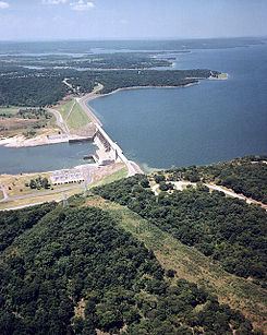
The relatively large water area results from the presence of Eufaula Lake and the Robert S. Kerr Reservoir. The South Canadian River forms the northern border with McIntosh and Muskogee counties before draining into the Arkansas River at the Robert S. Kerr Reservoir. The Arkansas is the northeastern border with Sequoyah County.
Major highways
Adjacent counties
National protected area
Demographics
As of the 2010 United States Census, there were 12,769 people residing in the county. 74.9% were White, 15.9% Native American, 0.5% Asian, 0.4% Black or African American, 1.2% of some other race and 7.0% of two or more races. 3.3% were Hispanic or Latino (of any race). 8.4% were of American, 7.3% German, 6.4% Irish and 5.0% English ancestry.
As of the census of 2000, there were 11,792 people, 4,624 households, and 3,380 families residing in the county. The population density was 20 people per square mile (8/km²). There were 5,573 housing units at an average density of 10 per square mile (4/km²). The racial makeup of the county was 78.24% White, 0.61% Black or African American, 14.60% Native American, 0.29% Asian, 0.45% from other races, and 5.81% from two or more races. 1.50% of the population were Hispanic or Latino of any race.
There were 4,624 households out of which 31.70% had children under the age of 18 living with them, 60.60% were married couples living together, 9.10% had a female householder with no husband present, and 26.90% were non-families. 24.70% of all households were made up of individuals and 13.00% had someone living alone who was 65 years of age or older. The average household size was 2.52 and the average family size was 3.00.
In the county, the population was spread out with 26.00% under the age of 18, 8.10% from 18 to 24, 24.50% from 25 to 44, 24.20% from 45 to 64, and 17.20% who were 65 years of age or older. The median age was 39 years. For every 100 females there were 95.70 males. For every 100 females age 18 and over, there were 92.40 males.
The median income for a household in the county was $24,553, and the median income for a family was $29,872. Males had a median income of $25,493 versus $17,462 for females. The per capita income for the county was $13,775. About 16.10% of families and 20.50% of the population were below the poverty line, including 25.10% of those under age 18 and 18.60% of those age 65 or over.
City
Towns
Census-designated place
Haskell County Courthouse
Stigler is home to the Haskell County Courthouse, which has become notable for erecting marble statues of the Ten Commandments and the Mayflower Compact on the front lawn (see Separation of church and state in the United States). In the seventh commandment, the word "adultery" is misspelled.
A unanimous federal appeals court ruled that county commissioners in Haskell County, Oklahoma unconstitutionally sought to promote their personal religious beliefs by erecting a Ten Commandments monument on the front lawn of the county's courthouse. The decision by the U.S. Tenth Circuit Court of Appeals comes in a challenge filed by the American Civil Liberties Union and the ACLU of Oklahoma on behalf of a local resident.
NRHP sites
The following sites in Haskell County are listed on the National Register of Historic Places: