
Country United States Area code(s) 539/918 Elevation 177 m Zip code 74944 Local time Thursday 10:09 AM | Time zone Central (CST) (UTC-6) FIPS code 40-44950 Area 2.8 km² Population 529 (2013) | |
 | ||
Weather 9°C, Wind SE at 10 km/h, 66% Humidity | ||
McCurtain is a town in Haskell County, Oklahoma, United States. The population was 516 at the 2010 census, a 14.7 increase from 466 at the 2000 census. A coal mine disaster in 1912 killed 73 miners and ended McCurtain's prosperity. The mine explosion remains one of the worst disasters in Oklahoma history.
Contents
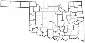
Map of McCurtain, OK, USA
History
In 1889, coal deposits discovered in the area that would become southern Haskell County attracted some European miners and American entrepreneurs. They established a community called Panther, which was renamed in 1902 to honor Choctaw Principal Chief Green McCurtain. Another mining town, Chant, was established nearby, and the two began to grow together. McCurtain and Chant prospered after the Fort Smith and Western Railroad connected McCurtain with Fort Smith, Arkansas in 1901. The railroad was built westward until it reached the Canadian River in 1902. The San Bois Coal Company built four hundred company houses for miners living in McCurtain and Chant. By 1907 statehood the combined population of the two communities was 1,760.
On March 20, 1912, an underground explosion in Mine Number Two killed 73 miners and bankrupted the San Bois Coal Company. With mining nearly played out, the combined population of McCurtain and Chat dropped to 1,341 in 1920. In 1922, McCurtain and Chant officially merged, with McCurtain as the surviving entity. The population continued to decline to 466 in 2000. According to the Encyclopedia of Oklahoma History and Culture, "The only reminder McCurtain had to show of its once prosperous past was a memorial standing silently at the site of old Mine Number Two and seventy-three graves in the nearby Miners Cemetery."
Geography
McCurtain is located at 35°9′1″N 94°58′17″W (35.150189, -94.971457). It is 57 miles (92 km) east of McAlester, Oklahoma and 28 miles (45 km) south southwest of Sallisaw.
According to the United States Census Bureau, the town has a total area of 1.1 square miles (2.8 km2), of which, 1.1 square miles (2.8 km2) of it is land and 0.04 square miles (0.10 km2) of it (1.77%) is water.
Demographics
As of the census of 2000, there were 466 people, 178 households, and 122 families residing in the town. The population density was 420.5 people per square mile (162.1/km²). There were 213 housing units at an average density of 192.2 per square mile (74.1/km²). The racial makeup of the town was 75.54% White, 16.74% Native American, 1.29% Asian, and 6.44% from two or more races. Hispanic or Latino of any race were 1.29% of the population.
There were 178 households out of which 36.0% had children under the age of 18 living with them, 54.5% were married couples living together, 11.8% had a female householder with no husband present, and 30.9% were non-families. 29.8% of all households were made up of individuals and 17.4% had someone living alone who was 65 years of age or older. The average household size was 2.62 and the average family size was 3.28.
In the town, the population was spread out with 30.5% under the age of 18, 9.2% from 18 to 24, 24.2% from 25 to 44, 21.7% from 45 to 64, and 14.4% who were 65 years of age or older. The median age was 34 years. For every 100 females there were 95.8 males. For every 100 females age 18 and over, there were 97.6 males.
The median income for a household in the town was $22,188, and the median income for a family was $29,167. Males had a median income of $29,167 versus $15,833 for females. The per capita income for the town was $11,410. About 16.2% of families and 22.5% of the population were below the poverty line, including 28.2% of those under age 18 and 25.0% of those age 65 or over.