
 | ||
Khanpur water fall haro river khanpur kpk go n explore
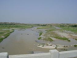
Haro is the name of a river that flows through parts of Khyber Pakhtunkhwa and Punjab . Its main valley is in Abbottabad District in the North West Frontier Province of northern Pakistan, identified with the Rigvedic Arjikiya. Its coordinates are 33°46'8" N and 72°14'43" E in DMS (Degrees Minutes Seconds) or 33.7689 and 72.2453 (in decimal degrees). Famous Khanpur Dam has been built on this river at Khanpur in the Haripur District to provide drinking water to the twin cities i.e. Islamabad (the capital of Pakistan) and Rawalpindi. The decrease in inlfows of Khanpur dam from Haro River results in water shortage in the twin cities during summer season.
Contents
Map of Haro River, Pakistan
It is fed by four major tributaries:
- The Lora Haro, rising in the Murree Hills around Lora
- The Satora Haro, rising in the Galiat Malach hills
- Both Lora Haro and Satora Haro merge at Dotara near Jabri
- The Neelan, rising in the Nara Hills
- The Kunhad, draining the area of Siribang and Dubran.
Minor tributaries include the following rivulets.
This river joins the Indus River near Ghazi Barotha Dam.