Hariharganj block is one of the administrative blocks of Palamu district, Jharkhand state, India. According to census (2001), the block has 13,579 households with aggregate population of 87,499. The block has 194 villages.
Map of Hariharganj, Jharkhand
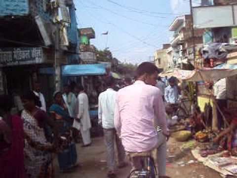
Hariharganj lies on the border of the Palamu district, along the National Highway 98. The people of this region primarily speak Magadhi.
Hariharganj is located at 24.50°N 84.27°E / 24.50; 84.27. It has an average elevation of 10,000 yards (9,100 m).
Hariharganj is situated at the border of Bihar and Jharkhand at NH-98. Facilities include police station, telephone exchange, post office, bus service, and Big Anaj Mandi (Aadhat) and others.
Durga Mandir is situated in Durga sthan, Gopal mandir and Hanuman mandir is situated at main bazar and two Bus Stand Old and New. It has two movie theaters, Mani Talkies and the Mani Theater.
No.of House Hold - 13579Geographical Area - 59,483 acres (24,072 ha)Total Population - 87499Total Population (Male) - 45397Total Population (Female)- 42102Total Literates - 34230Total Literate (Male) - 22859Total Literate (Female) - 11371The panchyayats under this block include:
- Saraiya
- Salaiya
- Pipra
- Dalpatpur
- Babhandih
- Semarwar
- Dhakcha
- Arruwa Khurd
- Satgawa or Hariharganj west part
- Satgawa or Hariharganj east part
- Siyar Bhucka
- Kataiya
- Kharagpur
- Sarsot
- Tendua
- Madhubana
- Kulahiya
- Belodar
- Dema
Financials:
Total Income: Rs. 159639807Total Expenditure: Rs. 151008640Primary Health Centres
Health - Sanctioned post-25, Working-16, vacancy-9Family Welfare - Sanctioned post-23, Working-11, vacancy-12Maleria - Sanctioned post-5, Working-2, vacancy-3Health FacilitiesThe citizens of this C.D.BLOCK avail 2 Allopathy Hospital, 2 Maternity & Child Welfare Center, 2 Registered Private Medical Practitioners
Drinking Water/Water SupplyThe main sources of water in this C.D.BLOCK are 1 tap water, 126 well water, 3 tank water, 112 handpump, 4 river, 3 canals
Post and TelegraphThere are 13 Post Office, 3 telephone connections
Communication facilities and approach to the villageThis block is linked with 22 Bus services
Banking facilitiesIt has 5 Commercial Bank, 3 Co-operative Commercial Bank.There are 2 Agricultural Credit Societies, 1 Other Credit Societies.
Power supplyIt has electricity connection and receives the power 19 for Domestic use, 8 for Agricultural use, 2 for Other purposes, 10 for all purposes.
Recreational facilitiesIt has 2 Cinema Hall/Video Halls
Land use/land cover and IrrigationOut of total area 8921.8 Hc. is under forest, 661 Hc. is under Culturable waste, 1409.34 Hc. is under unculturable wasteland (Area not available for cultivation)The irrigation is done on , 336.77 Hc. with Government canal, 114.6 Hc. with Private canal, 910.91 Hc. with well (without electricity), 425.43 Well (with electricity), 96.59 Hc. with Tube-Well (without Electricity), 24 Hc. with Tube-Well (with electricity), 238.29 Hc. with Tank, 44.04 Hc. with River, 27.08 Hc. with Lake, 905.98 Hc. with Others
Total Irrigated Area: 3123.69Total Unirrigated Area: 8587.12No. of schools:
Primary schools - 58Middle schools - 13High schools - 3Some of the notable educational institutes include:
Sita+2 High SchoolBalika Ucch VidyalayaMoti Raj Mahila Maha VidyalayaBal Kishore Singh Maha Vidyalaya