
Area 82.32 km² Local time Thursday 7:02 PM | Administrative centre Hareid Demonym(s) Hareidstøling Population 5,057 (2013) | |
 | ||
Weather 6°C, Wind SW at 37 km/h, 80% Humidity Points of interest Eismeermuseum Aarvak, Overåsanden ‑ Beach, Kvitneset | ||
Hareid is a municipality in Møre og Romsdal county, Norway. It is part of the Sunnmøre region. The administrative centre is the village of Hareid. The other main population centers are Brandal and Hjørungavåg.
Contents
- Map of Hareid Municipality Norway
- General information
- Name
- Coat of arms
- Churches
- Primary industries
- Industry
- Industrial companies
- Education
- References
Map of Hareid Municipality, Norway
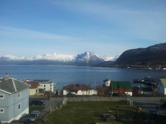
The municipality is situated off the mainland coast of Sunnmøre, on an island named Hareidlandet, which it shared with Ulstein Municipality, the commercial capital of the area. Hareid is regarded as the cultural capital with its annual Hareidsstemne and many choirs. It is also an important traffic hub in Sunnmøre and is connected by ferry to the neighboring island of Sula which in turn is connected to the city of Ålesund and the island of Valderøya. The municipality is connected to the mainland via the Eiksund Bridge and Eiksund Tunnel through Ulstein.
General information
The municipality of Hareid was established on 1 January 1917 when it was separated from Ulstein Municipality to form a municipality of its own. Originally, the municipality included the eastern part of Hareidlandet island and the southwestern part of Sula island. The initial population was 2,310. On 1 July 1958, the southwestern part of the island of Sula (population: 68) was transferred from Hareid Municipality to Borgund Municipality.
Name
The municipality (originally the parish) is named after the old Hareid farm (Old Norse: Haðareið), since the first church (Hareid Church) was built there. The first element is the genitive case of the name of the island Hǫð (now Hareidlandet) and the last element is eið which means "isthmus". The meaning of the name of the island is unknown. It is however speculated that it might be connected to the Norse god Höðr
Coat-of-arms
The coat-of-arms is from modern times. They were granted on 11 January 1985. The arms show three arrowheads as a symbol for the Battle of Hjörungavágr in 986, in which Earl Håkon defeated the Danish Vikings. This battle played an important role in the struggle by Håkon to unite the whole of Norway. Since the battle took place in the municipality, the arrowheads were considered an appropriate symbol.
Churches
The Church of Norway has one parish (sokn) within the municipality of Hareid. It is part of the Søre Sunnmøre deanery in the Diocese of Møre.
Primary industries
Primary industries such as fisheries and agriculture have traditionally been important ways of life in Hareid, and continue to be so for some of the population.
Industry
In recent years Hareid has developed into a modern industrial municipality with a variety of industries, including furniture, fish farming, offshore and subsea ship systems, and other manufacturers of ship equipment. Many Hareid companies specialize in manufacturing maritime equipment and components, and are part of the maritime cluster of Sunnmøre. Such clusters are considered by the EU to be powerful engines of economic development and drivers for innovation in Europe.
Industrial companies
Education
The town centre of Hareid is home to Hareid elementary school and Hareid junior high school, with two more elementary schools in more rural parts of the municipality.
After finishing junior high school in Hareid, students can complete a high school education in one of Hareid's neighbouring communitites such as Ulsteinvik or Ålesund.