
Local time Thursday 7:04 PM | District Yamamoto Population 7,346 (May 2015) | |
 | ||
Weather 3°C, Wind NW at 14 km/h, 82% Humidity Points of interest Ponpokoyamafurusato Park, Hachimoriiwadate Prefectural Natural P, Tehaizaka (momo village), Mizusawa Dam | ||
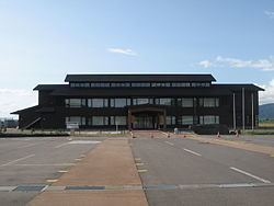
Happō (八峰町, Happō-chō) is a town located in Yamamoto District, Akita, in the northern Tohoku region of Japan. As of May 2015, the town had an estimated population of 7,346 and a population density of 31.4 persons per km2. The total area was 234.14 square miles (606.4 km2).
Contents
- Map of Happo Yamamoto District Akita Prefecture Japan
- Geography
- Neighboring municipalities
- History
- Economy
- Education
- Railway
- Highway
- Sister city relations
- References
Map of Happo, Yamamoto District, Akita Prefecture, Japan
Geography
Happō is located at the far northwestern of Akita Prefecture, bordered by the World Heritage Site Shirakami Mountains to the south, and by Aomori Prefecture to the north and the Sea of Japan to the west. Due to its location, the temperature in Happō can get remarkably cold at night, with snowfall tending to be somewhat greater than that in neighboring municipalities
Neighboring municipalities
History
The area of present-day Happō was part of ancient Dewa Province, dominated by the Satake clan during the Edo period, who ruled Kubota Domain under the Tokugawa shogunate. The modern town of Happō was created on March 27, 2006, by merging the village of Minehama, and the town of Hachimori, both from Yamamoto District.
Economy
The economy of Happō is based on agriculture and commercial fishing.
Education
Happō has three elementary schools and two middle schools.