
County Grafton Elevation 528 ft (161 m) Local time Wednesday 9:37 PM Population 11,260 (2010) | Incorporated 1761 Time zone Eastern (UTC−5) Zip code 03755 | |
 | ||
Weather -8°C, Wind W at 13 km/h, 75% Humidity Colleges and Universities Dartmouth College, University of New Hampshire | ||
Video of 56 river road hanover new hampshire real estate homes by linde mcnamara
Hanover is a town along the Connecticut River in Grafton County, New Hampshire, United States. The population was 11,260 at the 2010 census. CNN and Money magazine rated Hanover the sixth best place to live in America in 2011, and the second best in 2007. "This just might be the best college town," read the headline of a story in the January-February 2017 issue of Yankee.
Contents
- Video of 56 river road hanover new hampshire real estate homes by linde mcnamara
- Map of Hanover NH USA
- Sunny and contemporary mountain residence in hanover new hampshire
- History
- Etymology
- Geography
- Climate
- Demographics
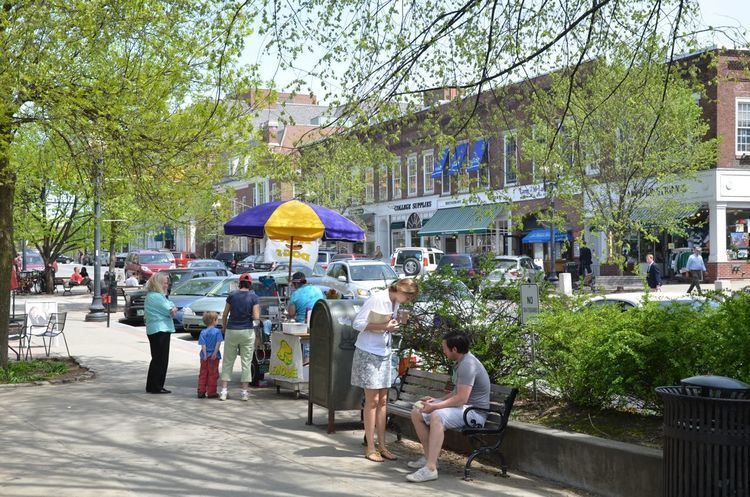
- Town center
- Education
- Economy
- Infrastructure
- References
Map of Hanover, NH, USA
Dartmouth College and the US Army Corps of Engineers Cold Regions Research and Engineering Laboratory are located there. The Appalachian Trail crosses the town.
The main village of the town, where 8,636 people resided at the 2010 census, is defined as the Hanover census-designated place (CDP), and is located at the junctions of New Hampshire routes 10, 10A, and 120. The town also contains the villages of Etna and Hanover Center.
Sunny and contemporary mountain residence in hanover new hampshire
History
Hanover was chartered by Governor Benning Wentworth on July 4, 1761, and in 1765–1766 its first European inhabitants arrived, the majority from Connecticut. Although the surface is uneven, the town developed into an agricultural community. Dartmouth College was established in 1769 beside the Common at a village called the Plain—an extensive and level tract of land a mile (1.6 kilometers) from the Connecticut River, and about 150 feet (46 meters) above it.
At one point in its history, the southwest corner of Hanover was known as Dresden, which in the 1780s joined other disgruntled New Hampshire towns along the Connecticut River that briefly defected to what was then the independent Republic of Vermont. For a time, Dresden was capital of the republic. After various political posturings, however, the towns returned to New Hampshire at the heated insistence of George Washington. One remnant of this era is that the name Dresden is still used in the Dresden School District, an interstate school district serving both Hanover and Norwich, Vermont—the first and one of the few inter-state school districts in the nation.
Etymology
"Hannover" (as it was spelled in the 1761 charter) was named either after a local parish in Sprague, Connecticut, or after the House of Hanover in honor of the reigning British king, George III.
While it is likely that the name "Dresden" derived from Dresden in Germany, it has also been suggested that it could derive directly from the old Sorbian word drezg ("forest") or Drezd'ane, for an inhabitant of a forest.
Geography
According to the United States Census Bureau, the town has a total area of 50.3 square miles (130.3 km2), of which 49.0 square miles (126.9 km2) is land and 1.3 square miles (3.4 km2) is water, comprising 2.52% of the town. The primary settlement in Hanover, where over 75% of the town's population resides, is defined as the Hanover census-designated place (CDP) and contains the areas around Dartmouth College and the intersections of New Hampshire Routes 10, 10A, and 120. The CDP has a total area of 5.0 square miles (13 km2), of which 4.6 square miles (12 km2) is land and 0.4 square miles (1.0 km2) is water.
Hanover borders the towns of Lyme, Canaan, and Enfield, New Hampshire; Norwich, Vermont; and the city of Lebanon, New Hampshire. Inside the limits of Hanover are the small rural villages of Etna and Hanover Center.
The highest point in Hanover is the north peak of Moose Mountain, at 2,313 feet (705 m) above sea level. Hanover lies fully within the Connecticut River watershed.
There are a number of trails and nature preserves in Hanover, and the majority of these trails are suitable for snowshoes and cross-country skis. The Velvet Rocks Trail, located on the Appalachian Trail, has a number of rock climbing and bouldering spots.
Climate
Hanover experiences a warm summer continental climate (Köppen Dfb), with long, cold, snowy winters, and warm, humid summers. Temperatures average 19.0 °F (−7.2 °C) in January to 70.9 °F (21.6 °C) in July, and the annual mean is 46.0 °F (7.8 °C). Extremes range from −40 °F (−40 °C), recorded on February 16, 1943, to 103 °F (39 °C), recorded on August 2, 1975.
Demographics
As of the census of 2010, there were 11,260 people, 3,119 households, and 1,797 families residing in the town. The population density was 220 people per square mile (86/km2). There were 3,278 housing units at an average density of 65.2 per square mile (25.2/km2). The racial makeup of the town was 81.0% White, 3.4% Black, 0.8% Native American, 10.8% Asian, 0.03% Pacific Islander, 0.7% from other races, and 3.2% from two or more races. Hispanic or Latino of any race were 3.9% of the population.
There were 3,119 households out of which 27.4% had children under the age of 18 living with them, 51.5% were married couples living together, 4.7% had a female householder with no husband present, and 42.4% were non-families. 31.0% of all households were made up of individuals and 16.1% had someone living alone who was 65 years of age or older. The average household size was 2.37 and the average family size was 2.95.
In the town, the population was spread out with 27.8% at or under the age of 19, 25.5% from 20 to 24, 14.4% from 25 to 44, 18.6% from 45 to 64, and 13.7% who were 65 years of age or older. The median age was 23 years.
For the period 2010-14, the estimated median income for a household in the town was $94,063, and the median income for a family was $129,000. Male full-time workers had a median income of $87,550 versus $53,141 for females. The per capita income for the town was $34,140. About 2.0% of families and 12.0% of the population were below the poverty line, including 3.4% of those under age 18 and 4.8% of those age 65 or over.
Town center
As of the census of 2000, there were 8,162 people, 1,829 households, and 967 families residing in the town's central settlement, or census-designated place (CDP). The population density was 1,792.2 people per square mile (692.6/km2). There were 1,891 housing units at an average density of 415.2 per square mile (160.5/km2). The racial makeup of the CDP was 85.27% White, 2.25% Black or African American, 0.61% Native American, 8.18% Asian, 0.09% Pacific Islander, 1.13% from other races, and 2.46% from two or more races. Hispanic or Latino of any race were 3.17% of the population.
There were 1,829 households out of which 26.2% had children under the age of 18 living with them, 46.8% were married couples living together, 4.8% had a female householder with no husband present, and 47.1% were non-families. 30.9% of all households were made up of individuals and 11.3% had someone living alone who was 65 years of age or older. The average household size was 2.37 and the average family size was 2.95.
In the CDP, the population was spread out with 11.1% under the age of 18, 49.0% from 18 to 24, 14.5% from 25 to 44, 12.0% from 45 to 64, and 13.5% who were 65 years of age or older. The median age was 22 years. For every 100 females there were 98.9 males. For every 100 females age 18 and over, there were 96.6 males.
The median income for a household in the CDP was $62,143, and the median income for a family was $90,548. Males had a median income of $56,667 versus $35,682 for females. The per capita income for the CDP was $26,426. About 1.0% of families and 14.7% of the population were below the poverty line, including none of those under age 18 and 4.6% of those age 65 or over.
Education
Economy
Hypertherm, White Mountains Insurance Group, and Daat Research Corp. are based in Hanover.
Infrastructure
The Hanover Water Company supplies water for downtown Hanover from several local reservoirs. The company is owned by Dartmouth College (52.8%) and the Town of Hanover (47.2%), with management by the Town of Hanover under a contract. In 2000, all full-time company employees became town employees. In recent years, the town has spent over $20 million to upgrade main water lines, and will undergo another $6 million project to build a new water treatment plant. Outside the downtown area, residents rely on private wells that are not maintained by the town.
FairPoint Communications furnishes telephone communication. The municipality provides sewage treatment.