
Length 48 km | ||
 | ||
Main source Lange Heide (Giehler Bach)45 m above sea level (NN) Similar | ||
The Hamme is a 48 km long river in Germany, Lower Saxony, north-east of Bremen. Its source is north of Osterholz-Scharmbeck. It flows through the moors north-east of Bremen called Teufelsmoor (German for dead moor), and meets the river Wümme in Ritterhude. From this junction, the river is called Lesum. The Lesum flows into the river Weser in Bremen-Vegesack.
Contents
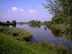
Map of Hamme, Germany
On the river Hamme there are many water-sport clubs, for example the Wassersportclub Hamme e.V. (watersports-club Hamme), the Ruder-Verein Osterholz-Scharmbeck von 1901 e.V. (Rowing Club Osterholz-Scharmbeck since 1901) and the Segel Club Hamme e.V. (Sailing Club Hamme).
CourseEdit
The upper reaches of the Hamme are called the Giehler Bach (Giehl Stream). The Giehler Bach originates in the heathland of the Lange Heide northeast of Osterholz-Scharmbeck, a geest plateau at a height of about 45 m above sea level (NN), which is also the source of many other geest streams (such as the Drepte, Scharmbecker Bach, Schönebecker Aue and Wienbeck). The sport designated as the "source" is the outlet of several drainage ditches on the plateau which is used for farming.
From this geest ridge, a terminal moraine from the Saale glaciation, the Giehler Bach flows northeastwards and descends within a few kilometers between the villages of Hülseberg and Freißenbüttel to a height about 15 m above sea level (NN). Near Ohlenstedt it is joined by waters from the Ohlenstedter Quellseen lakes and the river, falling very gently, then flows through the collective municipality of Hambergen to the Springmoor near Giehlermühlen (Vollersode) (5 m above sea level).
From there, the stream descends very gently to the Teufelsmoor, where it is finally discharges into the Hamme into the Giehler Moor near Viehspecken (4 m above sea level). It is also joined by the Hamme-Oste Channel (Kollbeck). Flowing very slowly, the Hamme now heads south through the glacial valley named after her.
Between the former moor colonies of Bornreihe and Hüttenbusch the river now continues in the direction of Worpswede, where it is joined by three left-hand tributaries, the Rummeldeisbeek, Schmoo and Umbeck. A few kilometers upstream the Beek enters from the right, draining most of the moors west of Hamme. Near the mouth of the Beek on the Hamme is the picturesque nature reserve of Breites Wasser, which is the largest remaining lake in the lowland region. From here the Hamme flows in a southwesterly direction past Osterholz-Scharmbeck towards Ritterhude.
In the 19th century, this part of the Hamme was straightened and the numerous meanders were cut at a total of seven places, so that the length of the river was reduced from 9 to 4.3 km. Behind the locks in Ritterhude, built in 1876, which keep the Hamme tide-free, the Hamme joins the tidal river of the Wümme near the city limits of Bremen and together they form the salt-waters of the Lesum, which enters the Weser 10 km downstream.
The total length of the river is 48 km and it descends through about 45 m.