
Length 35 km (22 mi) Mountains Folarskardnuten | Elevation 1,933 m (6,342 ft) | |
 | ||
Similar Hallingskarvet National Park, Hardangervidda, Haugastøl Station, Folarskardnuten, Prestholtseter | ||
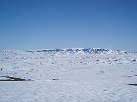
Hallingskarvet is a mountain range in southern Norway stretching from Geilo to Finse. The highest point is the 1,933-metre (6,342 ft) tall mountain Folarskardnuten, the highest point in Buskerud county.
Map of Hallingskarvet, 3577 Hovet, Norway
In the north, there is a large dammed lake called Strandavatnet. The Bergensbanen railway line, which runs south of Hallingskarvet, has its highest stop at Finse Station (1,222 m).
In 2006, the Hallingskarvet mountain range became part of the Hallingskarvet National Park.
References
Hallingskarvet Wikipedia(Text) CC BY-SA