
Prominence 917 m (3,009 ft) | Elevation 1,933 m | |
 | ||
Isolation 86.8 kilometres (53.9 mi) Topo map 1516 III Hallingskarvet Similar Sandfloegga, Stornubben, Tverrådalskyrkja, Visbretinden, Nautgardstind | ||
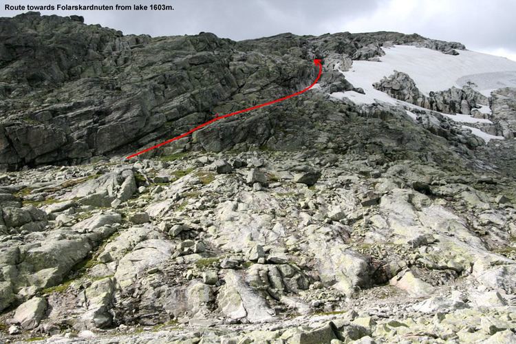
Folarskardnuten is the highest point on Hallingskarvet, and is also the highest point in the county Buskerud of Norway.
Map of Folarskardnuten, 3577 Hovet, Norway
The mountain lies within Hallingskarvet National Park.
References
Folarskardnuten Wikipedia(Text) CC BY-SA