
Admin. region Arnsberg Elevation 420 m (1,380 ft) Area 65.36 km² Local time Wednesday 6:56 AM Dialling code 02984 | District Hochsauerlandkreis Time zone CET/CEST (UTC+1/+2) Population 4,395 (30 Jun 2010) Postal code 59969 Administrative region Arnsberg | |
 | ||
Weather 7°C, Wind NW at 16 km/h, 94% Humidity | ||
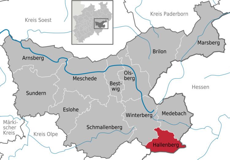
Hallenberg is a town in the Hochsauerland district, in North Rhine-Westphalia, Germany.
Contents
- Map of 59969 Hallenberg Germany
- Geography
- Neighbouring Places
- Division of the town
- Personalities
- Currency
- References
Map of 59969 Hallenberg, Germany
Geography
Hallenberg is situated approximately 15 km southeast of Winterberg and 35 km north of Marburg.
Neighbouring Places
Division of the town
Hallenberg consists of 4 districts: the town proper and 3 villages:
Personalities
Currency
From 1917 until the 1920s Hallenberg, like many German towns, produced its own currency, known as Notgeld. During the First World War this was because the value of the official coinage exceeded its face value, so coins were hoarded or sold for their metal, and then from about 1923 the rate of hyperinflation meant that the central bank could not print and distribute the ever-higher banknote values quickly enough, so this was done locally.
References
Hallenberg Wikipedia(Text) CC BY-SA