
Area 153.1 km² | Established March 24, 1970 | |
 | ||
Governing body Jeju Special Self-Governing Province | ||
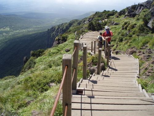
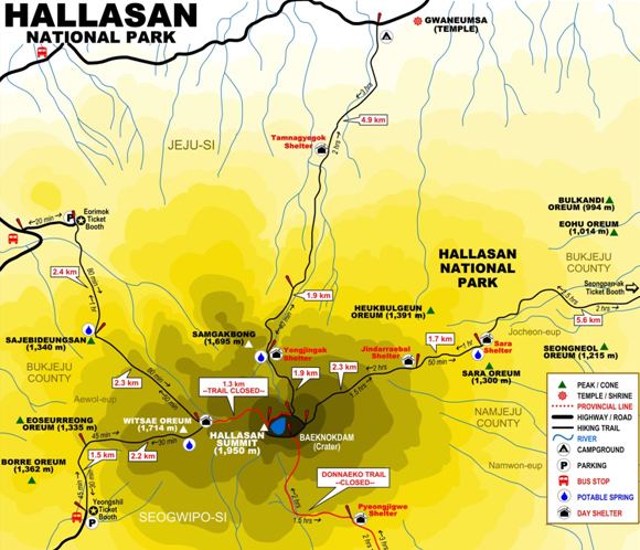
Hallasan national park yeongsil trail
Hallasan National Park (Korean: 한라산국립공원, 漢拏山國立公園) is located in the province of Jeju-do, South Korea. It was designated as the 9th national park in 1970. It features the highest mountain in South Korea, the shield volcano Hallasan on Jeju Island. It was designated a UNESCO Biosphere Reserve in 2002, and a World Heritage Site in 2007.
Contents
- Hallasan national park yeongsil trail
- Hiking jeju s hallasan national park steve miller s eye 4 canon eos c100
- Trails
- Topography
- References
Hallasan National Park is managed by Jeju Special Self-Governing Province. It is the only out of 20 national parks that is not managed by the Korea National Park Service.
Hiking jeju s hallasan national park steve miller s eye 4 canon eos c100
Trails
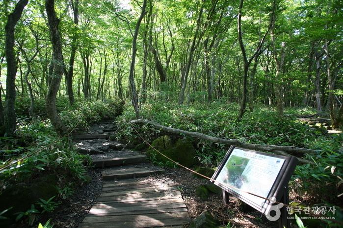
Hallasan has 7 trails: Eorimok Trail (6.8 km), Yeongsil Trail (5.8 km), Seongpanak Trail (9.6 km), Seokgulam Trail (1.5 km), Gwaneumsa Trail (8.7 km), Donnaeko Trail (7 km), and Eoseungsaengak Trail (1.3 km). The longest trail is Seongpanak Trail which takes about 4.5 hours.
Topography
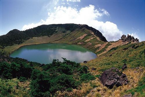
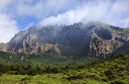
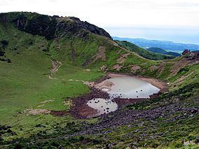
Hallasan comprises 153.112 km2 of the Jeju Island. It rises 1.950 m above the sea level which means the highest mountain in South Korea. This mountain was formed in the fourth Cenozoic era by outburst of volcano. It is mostly composed of basalts. It is extending east and west, and it has high and gradual descent. On the other hand, the south part of the mountain is steep. In the summit, there is a crater lake called “Baekrokdam.”
Since the mountain has high altitude, there are a number of alpine plants and animals. 1800 kinds of plants, including 400 kinds of specimen plants and 50 kinds of special plants, are living in Hallasan. So the Jeju island is designated by Biosphere Reserve in 2002 and Hallasan National Park is one of the region of Jeju Bioshere.