
 | ||
Hallamshire golf club a tour with dan walker
Hallamshire (or Hallam) is the historical name for an area of South Yorkshire, England, in the current city of Sheffield.
Contents
- Hallamshire golf club a tour with dan walker
- Sheffield railway station to the royal hallamshire hospital navigational cycle route
- Pre conquest Hallamshire
- After the Conquest
- Modern Hallam
- Connection to Robin Hood legend
- References
The origin of the name is uncertain. The English Place-Name Society describe "Hallam" originating from a formation meaning "on the rocks". Alternative theories are that it is derived from halgh meaning an area of land at a border, Old Norse hallr meaning a slope or hill, or Old English heall meaning a hall or mansion.
The exact boundaries of this historic district are unknown, but it is thought to have covered the parishes of Sheffield, Ecclesfield, and Bradfield—an area roughly equivalent to those parts of the present-day borough of the City of Sheffield that lie to the west of the rivers Don and Sheaf that are within the boundaries of the ancient county of Yorkshire (later descriptions also include Brightside and the parish of Handsworth).
Sheffield railway station to the royal hallamshire hospital navigational cycle route
Pre-conquest Hallamshire
In Anglo-Saxon times, Hallamshire was the most southerly of the "small shires" or regiones of the Kingdom of Northumbria. Its southern border with Mercia was already fixed and may have Celtic origins.
The mother church of Hallamshire lay five miles north of Sheffield at Ecclesfield, whose placename includes the Common Brittonic or primitive Welsh root *eglẽs meaning "church", suggesting that Hallamshire has even earlier roots and must have existed as a territorial unit at the time of the area's first conversion to Christianity during the Romano-British period.
On the basis of three separate extracts from the Domesday Survey it can be shown that the manors of Hallam, Attercliffe, and Sheffield were three distinct and separate entities at the time of the Survey and beyond. The Domesday Book states that the manor of Hallam ("Hallun") included sixteen hamlets or settlements and had existed before the 1066 Norman conquest of England as part of the lands owned by Waltheof, the Earl of Huntingdon, who had an aula or hall located in the manor of Hallam. From the Domesday text it is clear that the village of Hallam and Waltheof’s aula could only have been located in the manor of Hallam, and not the manors of Sheffield or Attercliffe (). However, the possibility that Waltheof's aula and the surrounding settlement was located in the manor of Sheffield still persists since the manor of Sheffield had once been demesne or inland of the manor of Hallam— a term which in this case implies "contained within". This has led to the suggestion that the Sheffield of the Domesday book somehow encompassed the area that later became known as Sheffield Park, the historic town and castle being in Hallam. Indeed, an early 20th-century excavation at the site of Sheffield Castle found evidence of an Anglo-Saxon building on the site. However, a number of alternate sites have been suggested in and around the Rivelin valley.
Local historian T. Walter Hall (in 1931), following Sidney Addy (1893), suggested that the district's original settlement was at Hallam Head, above the River Rivelin, and that it had been destroyed during the Harrying of the North. As evidence, he noted that the location lies by the ancient Long Causeway route and that the name of the neighbouring Burnt Stones Common referenced its destruction. A compilation of early maps of the area surrounding Hallam Head assembled by Hallam (2015) from a number of sources provides compelling evidence that a pre-Conquest nucleated settlement, almost assuredly the Domesday village of Hallam, was located immediately south of the old Roman road (Redmires Road) approximately 4.5 km west of Sheffield. The geographic centre coincides with the junction of Tom Lane and Carsick Hill Road; two ancient byways found mentioned in medieval charters from the 13th century. Hallam provides corroborating charter evidence that leads to the identification of the location Hallam Head, the site for the village of Hallam identified by T. Walter Hall in 1931, being situated near the upper end, or head of the village. A series of three communal fields designated Hallam fields (Hallam Field, Great Hallam Field and Common Fields of Hallam) are mentioned frequently in surrenders from 1550 onward in the context of common pasture. The apparent pattern of a nucleated settlement and associated three-field system would be analogous to ‘town planning’ without a town, had the village of Hallam not existed. The arguments presented by T. Walter Hall and Hallam are rejected by David Hey, who notes that there is no evidence of any settlement larger than a hamlet ever having existed at the site, and that evidence suggests that the Harrying of the North did not affect the Sheffield area. The simple fact that the village of Hallam and Waltheof's aula had been destroyed and no longer existed, and that the taxable value of the manors in the area had been significantly devalued by the time of the Domesday Survey would contradict Hay's position. Addy himself preferred a location just outside the village of Stannington, where there is evidence of a large manor house surrounded by a moat.
After the Conquest
Waltheof initially submitted to William I and was allowed to keep his lands. He took part in a failed uprising to support the 1069 invasion by Sweyn II of Denmark and Edgar Ætheling (including an attack on York), but then once again submitted to the William and was married to Judith of Lens, the King's niece. However, after taking part in a conspiracy against William in 1075 Waltheof was executed.
Initially, Judith retained his lands (including Hallamshire), but after Judith refused a second marriage to the Norman knight Simon Saint Liz, William confiscated much of her lands and handed them to her eldest daughter Maud, who then married Saint Liz in Judith's stead. After the death of Saint Liz, Maud married David, the heir to the crown of Scotland, and Waltheof's lands and Earldom were passed to him.
It is possible that Hallamshire was exempted from this transfer and remained in Judith's hands. The Domesday book states that the manor of Hallam was held by Roger de Busli "of the Countess Judith". The exact nature of the arrangement between Judith and de Busli is unknown, however there is evidence that such an arrangement may have continued for a number of centuries—an inquisition following the death of Thomas de Furnival in 1332 found that his ancestors had held the manor of Sheffield "of the King of Scotland", paying a yearly service of two white greyhounds.
The earliest known use of the term Hallamshire—"Halumsire"—is found in a deed of the house of Saint Wandrille in Ecclesfield dating from 1161. Historically, the term shire would simply mean the district appropriated to some city, town, or castle, and did not necessarily refer to a county. Hallamshire could therefore be assumed to be the district associated with a town ("vill") called "Hallam", although there is no known record of such a town's existence.
During this early period, the name Hallamshire was retained for the Norman lordship. It was administered from Sheffield Castle, at the confluence of the River Don and the River Sheaf. A smaller castle was built at High Bradfield. During the 12th century, William de Lovetot acquired most of the land within the Sheffield area including the old manors of Hallam, Sheffield, and Attercliffe. He constructed a more substantial castle in Sheffield, establishing the town as the dominant settlement within Hallamshire. Sheffield gained a sizeable parish, split from the large parish of Ecclesfield, and a larger manor which encompassed most of Hallamshire. A charter of 1268 describes Hallamshire as containing just three manors: Ecclesfield, Sheffield and Bradfield. However, confusion arose later, as Sheffield acquired other manors outside historic Hallamshire, such as that of Handsworth.
Hallamshire was included in official lists of the counties of England under Henry VIII in the 16th century.
The territorial division of Hallamshire survived into the 19th century as a liberty, recorded in 1822 as including the parishes of Sheffield, Treeton, Whiston, Rotherham, Handsworth, and Ecclesfield, and with the Duke of Norfolk as Chief Bailiff.
Modern Hallam
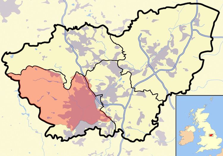
Hallam has come to mean, broadly speaking, that area of Yorkshire in the foothills of the Peak District and southwest of the River Don. The region includes much of western Sheffield, and the parish of Bradfield. Suburbs and villages within this area include Bradfield, Broomhill, Crookes, Fulwood, Hillsborough, Loxley, Stannington, Strines, and Walkley.
A number of institutions, companies, and public houses use the "Hallam/shire" name to reflect their association with the Sheffield area :
Connection to Robin Hood legend
The small village of Loxley, now a suburb of western Sheffield, lies within Hallamshire. A 1637 survey by John Harrison of the estates in or near Sheffield belonging to the Earl of Arundel states that a place called little Haggas croft in Loxley Firth contained "the foundacion of a house or cottage where Robin Hood was born". Antiquarian Joseph Hunter—writing in 1819—reaffirmed this local tradition, stating that Loxley Chase has "the fairest pretensions to be the Locksley of our old ballads, where was born that redoubtable hero Robin Hood." In many legends Robin Hood is said to have been a displaced son of the lord of Hallamshire, who at this period in history resided at his manor at Loxley. This also ties in with the traditional idea of Robin Hood being related to Scottish nobility, if not distantly, because the lords of Hallamshire were descendants of the early medieval kings of Scotland through the Earl of Huntingdon.