
 | ||
The Hackney Brook is one of the subterranean rivers of London. It crossed the northern parts of the current London boroughs of Hackney and Islington, emptying into the River Lea at Hackney Wick, with its source in Holloway.
Contents
Course of the RiverEdit
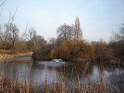
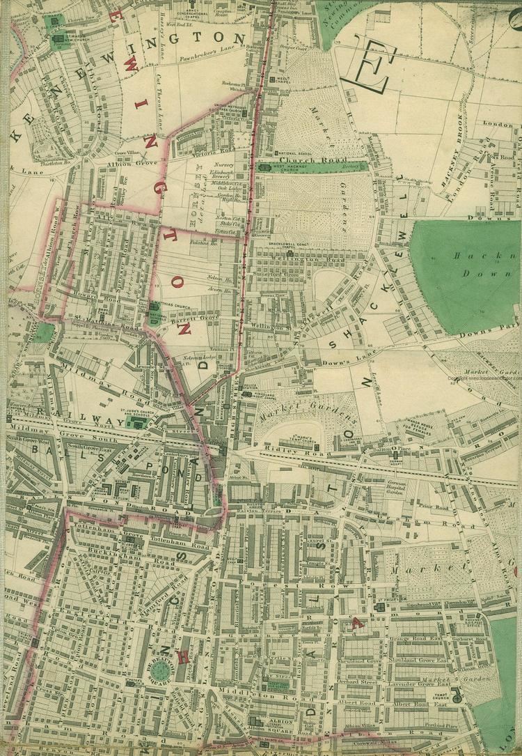
In Hackney, the river ran through the northern part of Clissold Park, where its course is now marked by two lakes. It crossed the artificial New River, which now flows at right angles to the brook and leaves the park to the south. The two Clissold park lakes are now fed from the main water supply, not the brook.
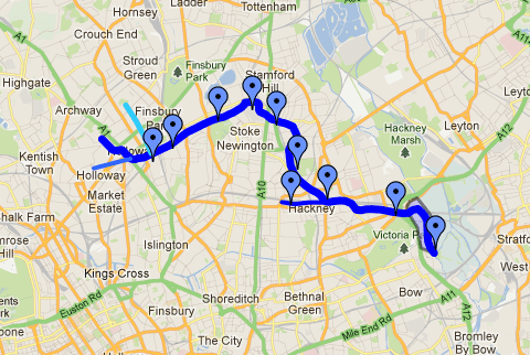
It then wandered through Abney Park Cemetery to cross at the bottom of the road Stamford Hill to run along the north side of Stoke Newington Common. At this point, builders found, in the 1860s, very early evidence of human occupation in the form of 200,000-year-old palaeolithic flint axes, which were being made on the banks of the brook. These are among the earliest human artifacts found in Britain.
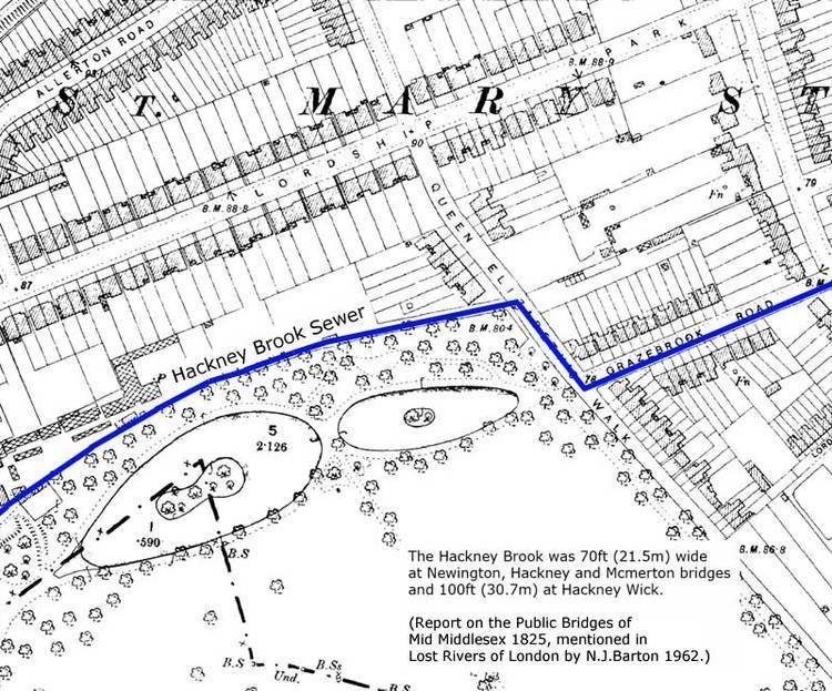
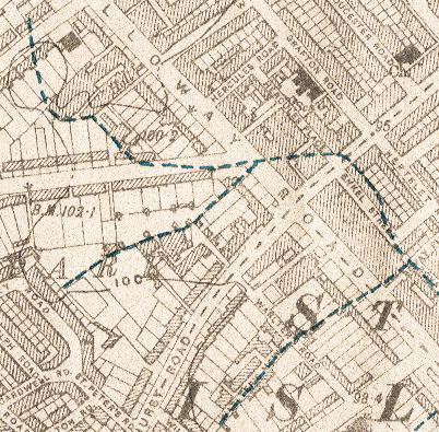
From here, the brook followed the western side of Hackney Downs, then ran south-east to cross Dalston Lane and Mare Street in Hackney Central near Bohemia Place. Many 18th and 19th-century illustrations show the ford here, which was at the bend in the road where the North London Railway bridge now crosses Mare Street. From here it ran through Homerton and Hackney Wick to join the Lea.
In its heyday, up until the late 1830s, the brook was a substantial river, 10 metres wide in full flood at Stoke Newington and perhaps 30 metres wide at its junction with the Lea.
Its course can be seen on some old maps [1].
DisappearanceEdit
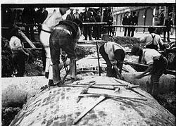
Although much of the Hackney Brook had already been covered over by 1856, local population growth in the area had turned the open portions into little more than an open sewer. In response to this, the Metropolitan Board of Works constructed its northern high-level sewer in 1860 to a design by Sir Joseph Bazalgette to contain the brook and its many tributaries. The sewer followed the course of the brook as far as Hackney Church Street (now Mare Street), but then struck south to cross Victoria Park, joining the larger sewer network at Old Ford. Subsequent sewerage building has resulted in the Hackney Brook becoming quite untraceable, lost somewhere in the subterranean labyrinth of piping.