
Country United States FIPS code 27-26378 Elevation 424 m Population 308 (2013) Area code 218 | Time zone Central (CST) (UTC-6) GNIS feature ID 0656495 Zip code 56452 Local time Tuesday 7:01 AM | |
 | ||
Weather -16°C, Wind W at 0 km/h, 60% Humidity Area 2.642 km² (2.616 km² Land / 3 ha Water) | ||
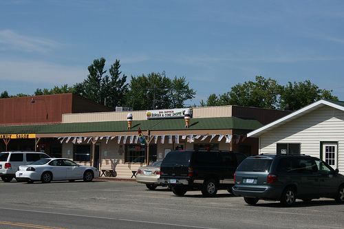
Hackensack is a city in Cass County, Minnesota, United States. The population was 313 at the 2010 census. It is part of the Brainerd Micropolitan Statistical Area.
Contents
- Map of Hackensack MN 56452 USA
- History
- Geography
- 2010 census
- 2000 census
- Education
- TV stations
- Radio stations
- References
Map of Hackensack, MN 56452, USA
History
A post office called Hackensack has been in operation since 1888. The city is named after Hackensack, New Jersey.
It is home to Paul Bunyan's sweetheart and wife since 1838 - Lucette.
Geography
According to the United States Census Bureau, the city has a total area of 1.02 square miles (2.64 km2), of which, 1.01 square miles (2.62 km2) is land and 0.01 square miles (0.03 km2) is water.
Minnesota State Highway 371 serves as a main route in the community.
Hackensack is located along the eastern shore of Birch Lake and maintains an asphalt boat ramp for lake access. Other lakes in the area include Pleasant Lake and Ten Mile Lake, the second-deepest natural lake in the state.
2010 census
As of the census of 2010, there were 313 people, 143 households, and 79 families residing in the city. The population density was 309.9 inhabitants per square mile (119.7/km2). There were 194 housing units at an average density of 192.1 per square mile (74.2/km2). The racial makeup of the city was 95.8% White, 1.0% Native American, and 3.2% from two or more races. Hispanic or Latino of any race were 0.3% of the population.
There were 143 households of which 25.9% had children under the age of 18 living with them, 42.0% were married couples living together, 4.9% had a female householder with no husband present, 8.4% had a male householder with no wife present, and 44.8% were non-families. 38.5% of all households were made up of individuals and 14% had someone living alone who was 65 years of age or older. The average household size was 2.13 and the average family size was 2.85.
The median age in the city was 45.1 years. 19.8% of residents were under the age of 18; 9.3% were between the ages of 18 and 24; 20.8% were from 25 to 44; 24.9% were from 45 to 64; and 25.2% were 65 years of age or older. The gender makeup of the city was 54.3% male and 45.7% female.
2000 census
As of the census of 2000, there were 285 people, 132 households, and 76 families residing in the city. The population density was 400.6 people per square mile (155.0/km²). There were 187 housing units at an average density of 262.9 per square mile (101.7/km²). The racial makeup of the city was 96.84% White, 2.11% Native American, and 1.05% from two or more races. Hispanic or Latino of any race were 0.35% of the population.
There were 132 households out of which 19.7% had children under the age of 18 living with them, 48.5% were married couples living together, 4.5% had a female householder with no husband present, and 42.4% were non-families. 36.4% of all households were made up of individuals and 18.9% had someone living alone who was 65 years of age or older. The average household size was 2.16 and the average family size was 2.74.
In the city, the population was spread out with 20.4% under the age of 18, 7.4% from 18 to 24, 23.9% from 25 to 44, 21.8% from 45 to 64, and 26.7% who were 65 years of age or older. The median age was 44 years. For every 100 females there were 88.7 males. For every 100 females age 18 and over, there were 90.8 males.
The median income for a household in the city was $24,375, and the median income for a family was $31,094. Males had a median income of $18,438 versus $25,556 for females. The per capita income for the city was $12,768. About 3.3% of families and 10.5% of the population were below the poverty line, including 2.0% of those under the age of eighteen and 10.8% of those sixty five or over.
Education
Hackensack Public Schools are part of the Walker-Hackensack-Akeley School District. Schools in the district include Walker-Hackensack-Akeley Elementary School and Walker-Hackensack-Akeley High School (WHA).
Hackensack students attend Walker-Hackensack-Akeley High School which is located in Walker.
Dr. Mary Donohue Stetz is the Superintendent of Schools.
TV stations
Hackensack is part of the Minneapolis / Saint Paul television market.
KCCW-TV is a full power station licensed to nearby Walker on channel 12 with transmitter located east of Hackensack on Woman Lake Road (Cass County Road 5). It does not originate programming but rebroadcasts WCCO-TV with no local input.
Cable and satellite television signals are also available.
Radio stations
FM
AM radio