
Website www.co.cass.mn.us Population 28,555 (2013) | Area 6,253 km² | |
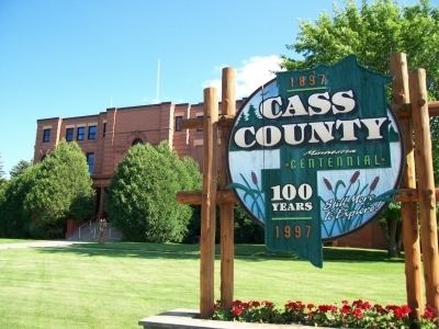 | ||
Founded September 1, 1851 (created)1897 (organized) Points of interest Northern Lights Casino, Ski Gull, Chippewa National Forest, Deep Portage Conservation, Lost 40 Scientific and Natur Destinations | ||
An evening on pike bay cass county minnesota
Cass County is a county located in the U.S. state of Minnesota. As of the 2010 census, the population was 28,567. Its county seat is Walker. The county was formed in 1851 and organized in 1897.
Contents
- An evening on pike bay cass county minnesota
- Map of Cass County MN USA
- History
- Geography
- National protected area
- Climate and weather
- Demographics
- Unorganized territories
- Census designated place
- References
Map of Cass County, MN, USA
Cass County is included in the Brainerd, MN Micropolitan Statistical Area.
A substantial portion of the Leech Lake Indian Reservation is in the county.
History
Cass County was created on September 1, 1851 by the legislature of the Minnesota Territory. It was not formally organized until 1897. Cass County was formed from portions of Dakota, Mahkatah, Pembina and Wahnata Counties. The county was named in honor of Lewis Cass. In turn, before formal organization, land from Cass County was split off to form other of the surrounding counties.
Geography
According to the U.S. Census Bureau, the county has a total area of 2,414 square miles (6,250 km2), of which 2,022 square miles (5,240 km2) is land and 393 square miles (1,020 km2) (16%) is water.
National protected area
Climate and weather
In recent years, average temperatures in the county seat of Walker have ranged from a low of 0 °F (−18 °C) in January to a high of 79 °F (26 °C) in July, although a record low of −44 °F (−42 °C) was recorded in February 1996 and a record high of 103 °F (39 °C) was recorded in August 1976. Average monthly precipitation ranged from 0.62 inches (16 mm) in February to 4.11 inches (104 mm) in July.
Demographics
As of the census of 2000, there were 27,150 people, 10,893 households, and 7,734 families residing in the county. The population density was 14 people per square mile (5/km²). There were 21,286 housing units at an average density of 11 per square mile (4/km²). The racial makeup of the county was 86.52% White, 0.11% Black or African American, 11.45% Native American, 0.28% Asian, 0.02% Pacific Islander, 0.14% from other races, and 1.47% from two or more races. 0.81% of the population were Hispanic or Latino of any race. 28.2% were of German, 15.0% Norwegian, 7.3% Swedish, 6.1% Irish and 6.1% American ancestry.
There were 10,893 households out of which 27.70% had children under the age of 18 living with them, 58.40% were married couples living together, 8.00% had a female householder with no husband present, and 29.00% were non-families. 25.00% of all households were made up of individuals and 11.90% had someone living alone who was 65 years of age or older. The average household size was 2.45 and the average family size was 2.90.
In the county, the population was spread out with 25.00% under the age of 18, 6.10% from 18 to 24, 23.00% from 25 to 44, 27.90% from 45 to 64, and 18.00% who were 65 years of age or older. The median age was 42 years. For every 100 females there were 101.90 males. For every 100 females age 18 and over, there were 100.60 males.
The median income for a household in the county was $34,332, and the median income for a family was $40,156. Males had a median income of $30,097 versus $21,232 for females. The per capita income for the county was $17,189. About 9.50% of families and 13.60% of the population were below the poverty line, including 18.20% of those under age 18 and 13.30% of those age 65 or over.