
Admin. region Detmold Elevation 106 m (348 ft) Area 70.67 km² Local time Saturday 3:41 PM Administrative region Detmold | Time zone CET/CEST (UTC+1/+2) Population 16,022 (30 Jun 2010) Dialling code 5257 | |
 | ||
Weather 9°C, Wind W at 16 km/h, 79% Humidity | ||
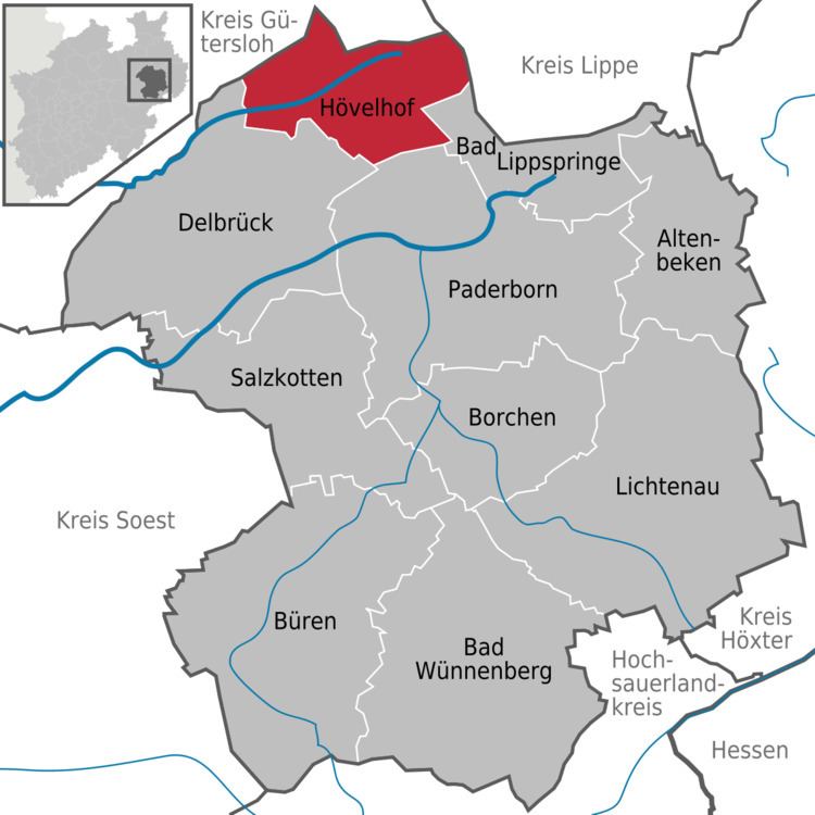
Hövelhof is a municipality in the district Paderborn, in North Rhine-Westphalia, Germany.
Contents
- Map of 33161 HC3B6velhof Germany
- Geography
- Neighbouring municipalities
- Division of the municipality
- Description
- Culture
- Politics
- Notable persons
- Twin towns
- References
Map of 33161 H%C3%B6velhof, Germany
Geography
Hövelhof is located in the Senne area, the eastern part of the Westfälische Bucht, approx. 10 km northwest of Paderborn.
Neighbouring municipalities
Division of the municipality
Description
Unusually for a village as small as Hövelhof, it is relatively self-contained—there are numerous supermarkets, restaurants, clothes shops, travel agencies, pubs and much more, meaning that the village could theoretically remain independent of the city of Paderborn. In fact, the only common feature of a full-fledged town that is missing from Hövelhof is a cinema, for which inhabitants do indeed need to venture into Paderborn City Center—approximately 15 km (10 mi) away. It also has five schools, its own fire brigade, and a library.
Culture
Hövelhof has two main festivals during the year. The first is the Schützenfest, a celebration of the St. Hubertus Hunters' Guild, which takes place on the hunting grounds. The second is the Hövelmarkt, a general village fair with not only market stalls, but also fairground rides and traditional German dances, complete with traditional music and costume.
Politics
The local government is dominated by the conservative CDU.