
Location South Korea Prominence 632 m Mountain range Gwangju Mountains | Elevation 632 m Province Gyeonggi Province Parent range Gwangju Mountains | |
 | ||
Similar Bukhansan, Samseongsan, Dobongsan, Cheonggyesan, Suraksan | ||
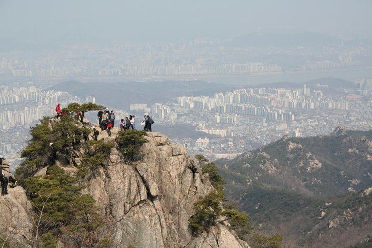
Hiking to gwanaksan
Gwanaksan (Korean for Mt. Gwanak; 632 m) is a small mountain in southern Seoul, South Korea. Portions lie in the Gwanak-gu and Geumcheon-gu districts of Seoul; other portions lie in the neighboring cities of Anyang and Gwacheon.
Contents
- Hiking to gwanaksan
- Map of Gwanaksan Jungang dong Gwacheon si
- Hiking korea gwanaksan seoul
- Trails
- References
Map of Gwanaksan, Jungang-dong, Gwacheon-si
The name gwanak means "hat-shaped peak," and refers to its gat-like profile. Thus Gwanaksan literally means "mountain of the hat-shaped peak." Currently it is referred to as "Gwanak," since san already contains the meaning of "mountain." Together with Songaksan in Kaesong, Gamaksan in Paju, Uaksan in Pocheon, and Hwaaksan in Gapyeong, Gwanaksan was long considered one of the five representative peaks of Gyeonggi-do (gyeonggi o-ak).
The main campus of Seoul National University is located just northwest of the mountain, and the Gwacheon national government complex lies to the east. Also nearby is the Anyang Resort Area, a popular local tourist attraction. On the mountain itself lie numerous Buddhist temples, including Wongaksa. Most of the mountain slope is protected land. The mountain is very popular with older climbers, since it can easily be reached by Seoul's public transportation. Annual hiking traffic is close to 5 million people. The Seoul side was designated a city park in 1968.
Hiking korea gwanaksan seoul
Trails
Seoul National University Entrance (11.3 km, 4 hours) Siheung-dong (11 km, 3 hours, 30 minutes) Anyang amusement park (12 km, 4 hours, 30 minutes)