
Main source Heiterwand Length 25 km | ||
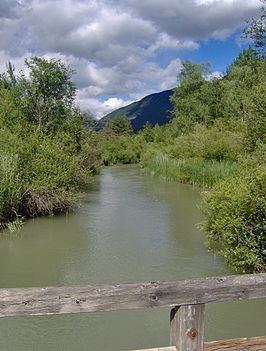 | ||
The Gurglbach originates on the mount Heiterwand near Nassereith from a height of approximately 2.630 m. It flows from west to east to Tarrenz village, the only village the Gurgl passes completely through. There, it changes its route and flows south to Imst where it merges with the Inn river 4 km away from the town. It has a length of approximately 25 km.
Contents
Map of Gurglbach, Austria
Water quality / dangers
The brook is one of the cleanest waters of Tyrol and has Grade A quality. It is a calm, slow running brook, surrounded by fauna and flora.
References
Gurglbach Wikipedia(Text) CC BY-SA