
Municipality Guijo de Santa Bárbara Elevation 876 m Local time Saturday 3:02 PM | Time zone CET (UTC+1) Area 35 km² Population 423 (2014) | |
 | ||
Weather 18°C, Wind SW at 14 km/h, 47% Humidity | ||
Guijo de santa b rbara c ceres
Guijo de Santa Bárbara is a municipality located in the province of Cáceres, Extremadura, Spain. According to the 2005 census (INE), the municipality has a population of 429 inhabitants.
Contents
- Guijo de santa b rbara c ceres
- Map of 10459 Guijo de Santa BC3A1rbara CC3A1ceres Spain
- Guijo de santa b rbara c ceres fiestas de santa b rbara 2015
- References
Map of 10459 Guijo de Santa B%C3%A1rbara, C%C3%A1ceres, Spain
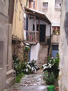
This village is located at Gredos Mountains and a river known as Garganta de Jaranda. Most of the land of the municipality is placed inside a natural space (LIC de la Sierra de Gredos).
The village is a typical destination for holidays, due to be near to Madrid (2 hours by car), and because of the opportunities for walking in the mountain and the river.
The population mainly works in touristic services (hostels, bars, etc.) and agriculture.
Main festivities are celebrated in August (14-15), September (8 and 9), and December (2-4) Other events are Viriato's Day in May and Trashumancia's Day in June–July.