
Elevation 354 m Local time Saturday 10:06 AM | Area 22 km² Population 2,143 (2014) | |
 | ||
Weather 22°C, Wind NW at 10 km/h, 43% Humidity | ||
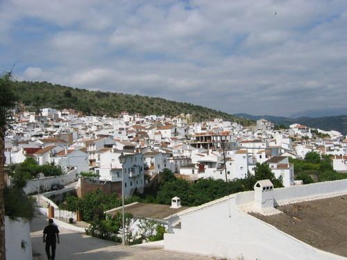
Guaro is a municipality in the province of Málaga in Andalusia southern Spain. It has a population of 2,228. It belongs to the Valle de Guadalhorce comarca and is 44 kilometres from the provincial capital of Málaga.
Contents
Map of Guaro, M%C3%A1laga, Spain
Geography
Guaro is at an altitude of 354 metres above sea level near the Sierra de Mijas. The land area is 22 square kilometres. Guaro's main economical activities are olive and almond agriculture, along with other traditional irrigated crops, and oddly-enough, as of 2006 the number of women with work contracts doubled that of men.
The first settlement in the area dates from Arabic times and was located at the place known as Old Guaro, at the feet of a tower that once was part of the line of fortifications of Guadalhorce valley. The municipality was conquered by the Catholic Monarchs in 1485. Guaro became an independent village on 1614 by decree of King Philip IV of Spain. The city is notable for its typical Andalus streets lined with white houses festooned with flowers. Its main monument is Saint Michel's parish, built in the 16th century and reformed in the early 17th century by Pedro Días de Palacios, that exhibits a square, two-bodied tower and no lateral vessels.