
First ascent Unknown Province Province of Málaga | Elevation 1,150 m Mountain range Penibaetic System | |
 | ||
Similar Calamorro, La Torrecilla, La Maroma, Sierra de Aguas, Gibralfaro | ||
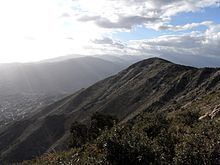
The Sierra de Mijas is a mountain range in southern Spain, part of the coastal mountain range that lies behind the Costa del Sol Occidental, in Andalusia. It separates the Valle del Guadalhorce region from the Costa del Sol.
Map of Sierra de Mijas, 29120, M%C3%A1laga, Spain
The highest point is the Pico Mijas at 1,150 metres. Geologically it is located in the inner part of the Cordillera Bética. It is traditionally divided into two sectors (Complejo alpujárride and Complejo maláguide), and is mostly composed of marble and, to a lesser extent, limestone.
References
Sierra de Mijas Wikipedia(Text) CC BY-SA