
Comarca Cuenca del Guadarrama Demonym(s) guadarrameño, -ña Area 56.98 km² Local time Saturday 6:21 AM | Municipality Guadarrama Elevation 981 m Population 15,547 (2014) | |
 | ||
Website Guadarrama's Town Council Weather 9°C, Wind N at 8 km/h, 51% Humidity | ||
El parque nacional de guadarrama
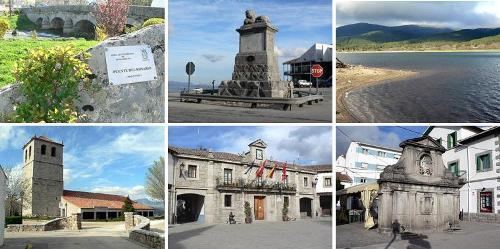
Guadarrama is a town and municipality in the Cuenca del Guadarrama comarca, in the Community of Madrid, Spain.
Contents
- El parque nacional de guadarrama
- Map of 28440 Guadarrama Madrid Spain
- Madrid desde el aire el viejo guadarrama
- References
Map of 28440 Guadarrama, Madrid, Spain
Pop: 13032 (winter, 2006 census), approx. 60000 (summer).
Founded by Arabs, its name comes from uadi-er-rameil river.
Guadarrama achieved the status of "villa" under Fernando V of Castile (II of Aragon) on November 22, 1504. Fernando VI ordered the building of a road to A Coruña through the Puerto de Guadarrama, by which it passed in 1808 the Grande Armée with Napoleon searching the Moore's Army.
This town was absolutely destroyed in the Spanish Civil War, as it was for almost three years battlefront, all today can see in this town is new, of mid-20th century.
It was the location for some scenes in the 1964 film The Fall of the Roman Empire.
It is close to Sierra de Guadarrama, a mountain range that is visited by Madrid residents seeking colder temperatures.