
Country United States ZIP codes 48230, 48236 Elevation 177 m Local time Friday 2:15 PM | Time zone EST (UTC-5) FIPS code 26-82453 Population 2,456 (2009) Area code 313 | |
 | ||
Weather -2°C, Wind NW at 32 km/h, 36% Humidity Area 49.81 km² (2.978 km² Land / 46.83 km² Water) | ||
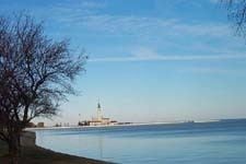
Grosse Pointe Shores is a city in the U.S. state of Michigan. With only 1.1 square miles (2.8 km2) land area, the city is the smallest of the five Grosse Pointe communities. The city, which is entirely residential, is the location of the Grosse Pointe Yacht Club on Lake Saint Clair. The city's population was 3,008 at the 2010 census. It has the 70th highest income for a municipality with over 1,000 citizens in the country and the second highest income in the state of Michigan.
Contents
- Map of Grosse Pointe Shores MI USA
- History
- Geography
- 2010 census
- 2000 census
- Education
- Notable people
- References
Map of Grosse Pointe Shores, MI, USA
On February 24, 2009, the residents of Grosse Pointe Shores voted to incorporate as a city with the name "Village of Grosse Pointe Shores, A Michigan City," which took place on April 1. Prior to incorporation as a city, the village encompassed the entire area of two small townships. Most of the former village was within Grosse Pointe Township in Wayne County. A tiny portion of the village was within Lake Township in Macomb County.
History
Grosse Pointe Shores was incorporated as a village in 1911. The village incorporated as a city in 2009. In 2011, the city government stated that it is considering trying to move all of the city into Macomb County, since Macomb County has lower taxes than Wayne County.
Geography
According to the United States Census Bureau, the city has a total area of 19.23 square miles (49.81 km2), of which 1.15 square miles (2.98 km2) is land and 18.08 square miles (46.83 km2) is water, (part of Lake St. Clair).
2010 census
As of the census of 2010, there were 3,008 people, 1,201 households, and 911 families residing in the city. The population density was 2,615.7 inhabitants per square mile (1,009.9/km2). There were 1,350 housing units at an average density of 1,173.9 per square mile (453.2/km2). The racial makeup of the city was 92.8% White, 1.9% African American, 0.3% Native American, 3.8% Asian, 0.2% from other races, and 1.0% from two or more races. Hispanic or Latino of any race were 1.9% of the population.
There were 1,201 households of which 24.6% had children under the age of 18 living with them, 68.0% were married couples living together, 4.8% had a female householder with no husband present, 3.0% had a male householder with no wife present, and 24.1% were non-families. 21.1% of all households were made up of individuals and 13.6% had someone living alone who was 65 years of age or older. The average household size was 2.50 and the average family size was 2.92.
The median age in the city was 52.2 years. 19.6% of residents were under the age of 18; 5.1% were between the ages of 18 and 24; 14.2% were from 25 to 44; 33.5% were from 45 to 64; and 27.6% were 65 years of age or older. The gender makeup of the city was 50.1% male and 49.9% female.
2000 census
As of the census of 2000, there were 2,823 people, 1,058 households, and 859 families residing in the village. The population density was 2,470.6 per square mile (956.1/km²). There were 1,096 housing units at an average density of 959.2 per square mile (371.2/km²). The racial makeup of the village was 93.80% White, 0.60% African American, 0.25% Native American, 4.07% Asian, 0.43% from other races, and 0.85% from two or more races. Hispanic or Latino of any race were 1.74% of the population.
There were 1,058 households out of which 28.1% had children under the age of 18 living with them, 74.5% were married couples living together, 4.6% had a female householder with no husband present, and 18.8% were non-families. 17.1% of all households were made up of individuals and 12.5% had someone living alone who was 65 years of age or older. The average household size was 2.67 and the average family size was 3.01.
The median income for a household in the village was $113,882, and the median income for a family was $139,680. Males had a median income of $100,000 versus $59,375 for females. The per capita income for the village was $97,639. About 2.7% of families and 3.0% of the population were below the poverty line, including 4.6% of those under age 18 and 3.4% of those age 65 or over.
Education
The city lies within two separate school districts.
The portion in Wayne County is within the Grosse Pointe Public School System. Residents of the GPPSS area are divided between Ferry Elementary School and Monteith Elementary School, and all residents of that section are zoned to Parcells Middle School and Grosse Pointe North High School; all of these schools are in Grosse Pointe Woods.
The portion of the community in Macomb County is within the South Lake School District.