
Elevation 656 m (2,152 ft) Time zone CET (UTC+1) Local time Friday 7:52 PM Dialling code 0342 | Frazioni Tiolo, Ravoledo Demonym(s) Grosini Area 127 km² Postal code 23033 | |
 | ||
Weather 11°C, Wind NE at 13 km/h, 23% Humidity | ||
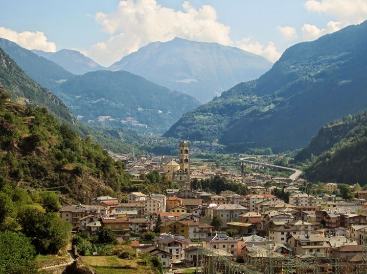
Grosio is a comune (municipality) in the Province of Sondrio in the Italian region Lombardy, located about 130 kilometres (81 mi) northeast of Milan and about 35 kilometres (22 mi) northeast of Sondrio, on the border with Switzerland. As of 31 December 2004, it had a population of 4,790 and an area of 127.0 square kilometres (49.0 sq mi).
Contents
Map of 23033 Grosio Province of Sondrio, Italy
The municipality of Grosio contains the frazioni (subdivisions, mainly villages and hamlets) Tiolo and Ravoledo.
Grosio borders the following municipalities: Grosotto, Monno, Poschiavo (Switzerland), Sondalo, Valdidentro, Valdisotto, Vezza d'Oglio.
On the hillside of Grosio lie the ruins of the S. Faustino and Visconti Venosta castles, the latter being mostly reconstructed and the former bearing only trace evidence of its former location save for a rebuilt chapel on the site. In the same location one can find petroglyphs dating from 2200 to 1000 BCE.
At the center of Grosio is the 17th century church of San Giorgio. Inside, the single-nave church contains many frescoes by Cipriano Valorosa, the "Raphael of Valtellina". At the other end of town is the large parish church of San Giuseppe.