
Country Norway District Namdalen Area rank 87 in Norway Area 1,136 km² Local time Friday 6:54 PM | County Nord-Trøndelag Administrative centre Mediå Time zone CET (UTC+1) Population 2,357 (2011) Official language form Norwegian Language | |
 | ||
Weather -3°C, Wind S at 2 km/h, 88% Humidity | ||
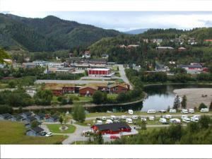
Grong (Southern Sami: Kråangke) is a municipality in Nord-Trøndelag county, Norway. It is part of the Namdalen region. The administrative centre of the municipality is the village of Medjå. Other villages in the municipality include Bergsmoen, Formofoss, Gartland, and Harran.
Contents
- Map of Grong Municipality Norway
- General information
- Name
- Coat of arms
- Churches
- Geography
- Government
- Municipal council
- Transportation
- References
Map of Grong Municipality, Norway
General information
Grong was established as a municipality on 1 January 1838 (see formannskapsdistrikt). On 1 January 1901, the northwestern district of Høylandet (population: 1,046) was separated from Grong to form its own municipality. On 1 January 1923, the northeastern district of Røyrvik (population: 392), the northwestern district of Namsskogan (population: 469), and the central district of Harran (population: 630) were all split from Grong to form separate municipalities. This left a vastly smaller municipality of Grong with only 1,272 residents. On 1 January 1964, the municipality of Harran (population: 1,085) was merged back into Grong.
Name
The municipality (originally the parish) is named after the old Grong farm (Old Norse: Granungar), since the first church was built there. The first element is grǫn which means "spruce" and the last element is the plural form of the suffix -ungr.
Coat-of-arms
The coat-of-arms is from modern times; they were granted on 6 February 1987. The arms show three green triangles on a silver/gray background. The green triangles represent spruce trees (gran), making them canting arms. The name is supposedly derived from Granungar. The number three symbolizes the three main villages in the municipality: Harran, Bergsmoen, and Medjå.
Churches
The Church of Norway has two parishes (sokn) within the municipality of Grong. It is part of the Namdal deanery in the Diocese of Nidaros.
Geography
Grong is located along the river Namsen in the Namdalen valley. Two major tributaries of the Namsen flow through Grong too: the river Sanddøla and the river Neselva. The Bangsjøene lakes lie at the extreme southern border with Snåsa and Overhalla. The Blåfjella–Skjækerfjella National Park covers a small part of the southeastern part of Grong.
Government
All municipalities in Norway, including Grong, are responsible for primary education (through 10th grade), outpatient health services, senior citizen services, unemployment and other social services, zoning, economic development, and municipal roads. The municipality is governed by a municipal council of elected representatives, which in turn elect a mayor.
Municipal council
The municipal council (Kommunestyre) of Grong is made up of 17 representatives that are elected to every four years. Currently, the party breakdown is as follows:
Transportation
The European route E6 highway follows the river Namsen across the municipality, as does the Nordland Line. The two main stations on the Nordland Line are Grong Station in Medjå and Harran Station in Harran. The old Namsos Line railway used to run from Grong to Namsos, but that is now closed.