Supriya Ghosh (Editor)

Großer Krottenkopf

Updated on
Edit
Like
Comment
Share on FacebookTweet on TwitterShare on LinkedInShare on Reddit
Prominence
  
996 m (3,268 ft)

Elevation
  
2,656 m

Parent range
  
Allgäu Alps

Location
  
Tyrol, Austria

Mountain range
  
Allgäu Alps

Großer Krottenkopf httpsuploadwikimediaorgwikipediacommons33

Similar
  
Mädelegabel, Hohes Licht, Hochvogel, Marchspitze, Trettachspitze

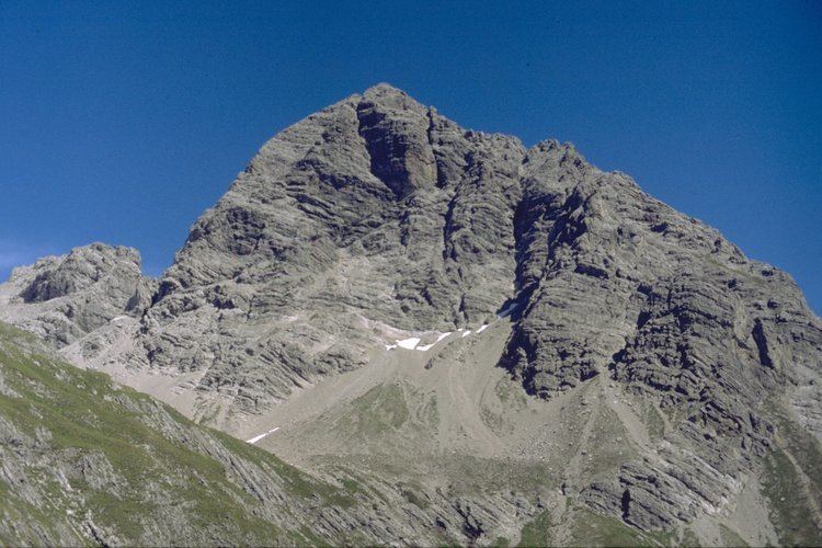
The Großer Krottenkopf is the highest mountain in the Allgäu Alps of Austria. It is 2,656 m (AA) and is part of a side branch of the Hornbach chain, which branches off the main chain of the Allgäu Alps and runs for about 15 km eastwards.

Contents

Map of Gro%C3%9Fer Krottenkopf, 6646, Austria

Bases and ascent routesEdit

  • From Oberstdorf (815 m above NN), the Kemptner Hut at 1,844 m above NN summit can be reached in four hours via the Spielmannsau using the E5 European long distance path.
  • The Kemptner Hut is the northern base for an ascent on the Krottenkopf using the normal route (easiest ascent). The path runs from the hut initially southwards, then swings east to theOberer Mädelejoch (2,033 m (AA)) on the border between Germany and Austria. It then runs over scree eastwards to the col of Krottenkopfscharte (2,350 m (AA)) and, following the numerous red dots, requires an easy climb (UIAA grade I) over stone-covered slabs to the summit in just under three hours. Sure-footedness and, in the summit region, a head for heights are required.
  • Another path leads from Holzgau (1,103 m (AA)) in the upper Lech valley to the Großer Krottenkopf. The E 5 path runs through the Höhenbachtal valley northwards and past the Simms Waterfall (with its snack bar or Jausenstation) and on to the Untere Roßgumpenalpe. Just below the lower Mädelejoch the path forks off
  • to the Krottenkopfscharte. This tour takes just under four hours.

  • Alternatively there is an ascent from the Bernhardseck Hut (1,802 m (AA)), past the Mutte and the Strahlkopf (2,388 m (AA)), or from Elbigenalp in the Lech valley up the Bernhardstal valley.
  • There is a climbing route along the north arête. This involves two short and one longer vertical passages at UIAA grade III. The starting point is the notch of Hermannskarscharte, which is reached on a trackless route from the Kemptner Hut through the cirque of Öfner Kar.
  • Literature and mapsEdit

  • Dieter Seibert, Allgäuer Alpen, Alpine Club Guide, Munich, 2004, ISBN 3-7633-1126-2
  • Alpine Club map 1:25,000 series, Sheet 2/1, Allgäuer- Lechtaler Alpen, West
  • References

    Großer Krottenkopf Wikipedia