Isolation 6.77 mi (10.89 km) Elevation 4,266 m Age of rock Oligocene | Easiest route Scramble, class 2+ Prominence 582 m Parent range Collegiate Peaks | |
 | ||
Listing North America highest peaks 61st
US highest major peaks 46th
Colorado highest major peaks 26th Location Continental Divide between
Chaffee and Pitkin counties, Colorado, United States Topo map USGS 7.5' topographic map
Independence Pass, Colorado Mountain range Sawatch Range, Collegiate Peaks Similar Mount Ouray, Vermilion Peak, Casco Peak, Clinton Peak, French Mountain | ||
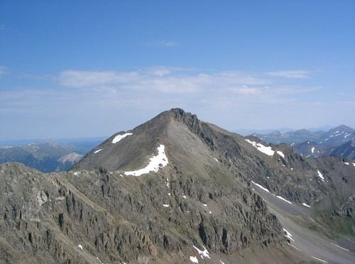
Grizzly Peak is a high and prominent mountain summit of the Collegiate Peaks in the Sawatch Range of the Rocky Mountains of North America. The 13,995-foot (4265.6 m) thirteener is located 2.6 miles (4.2 km) south-southwest (bearing 202°) of Independence Pass, Colorado, United States, on the Continental Divide separating San Isabel National Forest and Chaffee County from White River National Forest and Pitkin County.
Contents
- Map of Grizzly Peak Colorado 81210 USA
- ElevationEdit
- GeologyEdit
- Historical namesEdit
- Other summits with same nameEdit
- References
Map of Grizzly Peak, Colorado 81210, USA
ElevationEdit
Grizzly Peak is the highest summit in the United States less than 14,000 feet (4,267.2 m), making it the highest thirteener in the country. At one time, the peak's elevation was measured to be over 14,000 feet and was believed to be a fourteener, but more recent and accurate surveys have dropped it below that threshold.
GeologyEdit
The mountain is composed of andesite lava flows and breccias of Oligocene age.
Historical namesEdit
Other summits with same nameEdit
Grizzly Peak is not only the name of Colorado's highest thirteener, but the state has four other Grizzly Peaks plus one Grizzly Mountain on the list:
