Population 995 (2011) Sovereign state United Kingdom Local time Friday 2:42 PM | OS grid reference TF392878 Post town LOUTH Dialling code 01507 | |
 | ||
Weather 11°C, Wind S at 19 km/h, 80% Humidity | ||
Grimoldby is a village and civil parish in the East Lindsey district of Lincolnshire, England. It is situated 4 miles (6 km) east from Louth. The 2001 Census reported a village population of 1151, reducing at the 2011 census to 995.
Contents
Map of Grimoldby, Louth, UK
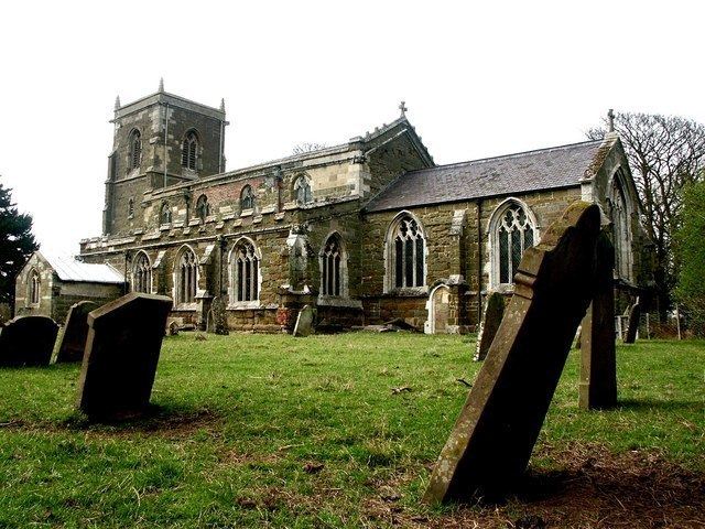
Grimoldby Grade I listed Anglican church is dedicated to St Edith. It is of early Perpendicular style with embattled and crocketed aisles and clerestory, set with gargoyles.
In 1885 Kelly's Directory reported that the chief crops grown were wheat, barley, beans and oats, and that Grimoldby had three chapels, Wesleyan, Primitive Methodist and Free Methodist, and a National School.
Village amenities include a Londis shop, Grimoldby Primary School, a nursery, an Italian restaurant, public house and a cricket club. Amenities also serve the adjoining village of Manby, which is 0.5 miles (0.8 km) to the south, separated from Grimoldby by the B1200.
Grimoldby used to have a railway station.
Governance
An electoral ward in the same name exists. Grimoldby is in the centre of this ward which had a population taken at the 2011 census of 2181.
