
Province / Metropolitan city none Demonym(s) Gressonards Area 65 km² Local time Friday 9:46 AM | Region Valle d'Aosta Elevation 1,635 m (5,364 ft) Time zone CET (UTC+1) Postal code 11020 Dialling code 0125 | |
 | ||
Weather 4°C, Wind N at 19 km/h, 32% Humidity Points of interest Monterosa Ski, Vincent Pyramid, Lyskamm, Schwarzhorn, Ecomuseo Walser | ||
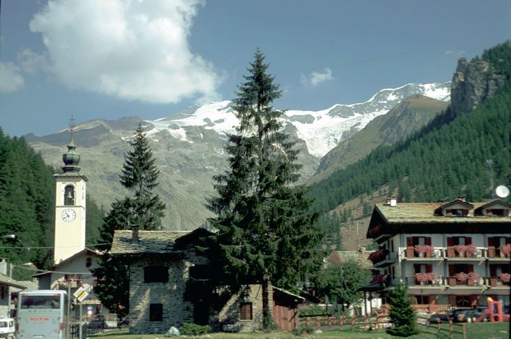
Gressoney-La-Trinité (Walser German: Greschòney Drifaltigkeit or Creschnau Drifaltigkeit) is a town and comune in the Val de Gressoney, part of the Aosta Valley region of northwestern Italy.
Contents
- Map of 11020 Gressoney La TrinitC3A9 Aosta Valley Italy
- Geography
- History
- Walser culture and language
- References
Map of 11020 Gressoney-La-Trinit%C3%A9, Aosta Valley, Italy
Geography
At an elevation of 1,635 metres (5,364 ft) above sea level, Gressoney-La-Trinité is the highest village in the Val de Gressoney, the valley of the river Lys.
History
The area was settled by the Walser people from the Valais. They left behind characteristic "Walser houses", or Stadel, buildings made of wood and stone sitting on short mushroom-shaped pillars.
Walser culture and language
Though historically Gressoney-La-Trinité and Gressoney-Saint-Jean are two separate comunes, they form a Walser German cultural unity known as Greschòney or Creschnau in Greschoneytitsch (or simply Titsch), the local Walser German dialect, or Kressenau in German. They were united into one commune named Gressoney from 1928 until 1946, when the two former communes were reconstituted.
An example of Greschòneytitsch: