
Congressional district At-large Area 2,730 km² Population 4,242 (2013) | Founded 1862 Unemployment rate 3.9% (Apr 2015) | |
 | ||
Rivers Missouri River, Ponca Creek, Mud Creek, Murphy Creek | ||
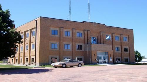
Gregory County is a county located in the U.S. state of South Dakota. As of the 2010 census, the population was 4,271. Its county seat is Burke. The county was created in 1862 and organized in 1898. It was named for the politician J. Shaw Gregory.
Contents
- Map of Gregory County SD USA
- Geography
- Major highways
- Adjacent counties
- National protected area
- 2000 census
- 2010 census
- Cities
- Towns
- Census designated place
- Townships
- Unorganized territories
- Economy
- National Register of Historic Places sites
- References
Map of Gregory County, SD, USA
Geography
According to the U.S. Census Bureau, the county has a total area of 1,054 square miles (2,730 km2), of which 1,015 square miles (2,630 km2) is land and 39 square miles (100 km2) (3.7%) is water.
Major highways
Adjacent counties
National protected area
2000 census
As of the census of 2000, there were 4,792 people, 2,022 households, and 1,290 families residing in the county. The population density was 5 people per square mile (2/km²). There were 2,405 housing units at an average density of 2 per square mile (1/km²). The racial makeup of the county was 93.18% White, 0.04% Black or African American, 5.59% Native American, 0.23% Asian, 0.10% from other races, and 0.86% from two or more races. 0.86% of the population were Hispanic or Latino of any race. 50.0% were of German, 7.9% Czech, 6.3% Irish, 5.7% American and 5.5% English ancestry.
There were 2,022 households out of which 26.40% had children under the age of 18 living with them, 55.20% were married couples living together, 5.70% had a female householder with no husband present, and 36.20% were non-families. 33.90% of all households were made up of individuals and 20.30% had someone living alone who was 65 years of age or older. The average household size was 2.32 and the average family size was 2.98.
In the county, the population was spread out with 24.30% under the age of 18, 5.10% from 18 to 24, 22.00% from 25 to 44, 23.80% from 45 to 64, and 24.80% who were 65 years of age or older. The median age was 44 years. For every 100 females there were 94.50 males. For every 100 females age 18 and over, there were 91.90 males.
The median income for a household in the county was $22,732, and the median income for a family was $30,833. Males had a median income of $21,063 versus $16,920 for females. The per capita income for the county was $13,656. About 15.10% of families and 20.10% of the population were below the poverty line, including 24.50% of those under age 18 and 20.60% of those age 65 or over.
2010 census
As of the 2010 United States Census, there were 4,271 people, 1,936 households, and 1,172 families residing in the county. The population density was 4.2 inhabitants per square mile (1.6/km2). There were 2,503 housing units at an average density of 2.5 per square mile (0.97/km2). The racial makeup of the county was 89.6% white, 7.5% American Indian, 0.3% Asian, 0.2% black or African American, 0.2% from other races, and 2.2% from two or more races. Those of Hispanic or Latino origin made up 0.9% of the population. In terms of ancestry, 54.5% were German, 11.4% were Irish, 10.9% were Czech, 7.1% were English, 6.0% were Norwegian, and 2.4% were American.
Of the 1,936 households, 23.7% had children under the age of 18 living with them, 49.9% were married couples living together, 7.4% had a female householder with no husband present, 39.5% were non-families, and 36.6% of all households were made up of individuals. The average household size was 2.18 and the average family size was 2.84. The median age was 48.2 years.
The median income for a household in the county was $33,940 and the median income for a family was $44,333. Males had a median income of $30,401 versus $25,804 for females. The per capita income for the county was $21,311. About 10.7% of families and 16.0% of the population were below the poverty line, including 27.1% of those under age 18 and 19.2% of those age 65 or over.
People
Cities
Towns
Census-designated place
Townships
The county is divided into thirteen townships:
Unorganized territories
The county has four areas of unorganized territory:
Economy
Farming and ranching are two main economic factors of the county.