
County Plumas FIPS code 06-31162 Elevation 1,093 m Zip code 95947 Area code Area code 530 | Time zone Pacific (PST) (UTC-8) GNIS feature ID 1658666 Area 20.7 km² Population 1,129 (2010) | |
 | ||
Similar Lake Almanor, Lake Oroville, Eagle Lake (Lassen County) | ||
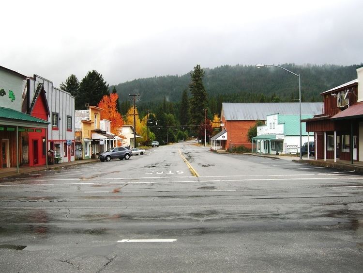
Driving through small town greenville california around the plumas national forest
Greenville is a census-designated place (CDP) in Plumas County, California, United States, on the north-west side of Indian Valley. The population was 1,129 at the 2010 census, down from 1,160 at the 2000 census.
Contents
- Driving through small town greenville california around the plumas national forest
- Map of Greenville CA 95947 USA
- Greenville california 95947 plumas county usa fall color 2013
- Geography
- Climate
- 2010
- 2000
- Politics
- Famous residents
- References
Map of Greenville, CA 95947, USA
Greenville california 95947 plumas county usa fall color 2013
Geography
Greenville is located at 40°8′24″N 120°57′5″W (40.140069, -120.951268).
According to the United States Census Bureau, the CDP has a total area of 8.0 square miles (21 km2), all of it land.
Climate
This region experiences hot and dry summers with temps as high as 104°Fand cold sometimes wet winters as cold as 0°F °F. According to the Köppen Climate Classification system, Greenville has a warm-summer Mediterranean climate, abbreviated "Csb" on climate maps.
2010
The 2010 United States Census reported that Greenville had a population of 1,129. The population density was 141.3 people per square mile (54.5/km²). The racial makeup of Greenville was 897 (79.5%) White, 1 (0.1%) African American, 133 (11.8%) Native American, 11 (1.0%) Asian, 0 (0.0%) Pacific Islander, 17 (1.5%) from other races, and 70 (6.2%) from two or more races. Hispanic or Latino of any race were 109 persons (9.7%).
The Census reported that 1,129 people (100% of the population) lived in households, 0 (0%) lived in non-institutionalized group quarters, and 0 (0%) were institutionalized.
There were 496 households, out of which 139 (28.0%) had children under the age of 18 living in them, 181 (36.5%) were opposite-sex married couples living together, 77 (15.5%) had a female householder with no husband present, 25 (5.0%) had a male householder with no wife present. There were 52 (10.5%) unmarried opposite-sex partnerships, and 3 (0.6%) same-sex married couples or partnerships. 171 households (34.5%) were made up of individuals and 67 (13.5%) had someone living alone who was 65 years of age or older. The average household size was 2.28. There were 283 families (57.1% of all households); the average family size was 2.91.
The population was spread out with 256 people (22.7%) under the age of 18, 78 people (6.9%) aged 18 to 24, 227 people (20.1%) aged 25 to 44, 378 people (33.5%) aged 45 to 64, and 190 people (16.8%) who were 65 years of age or older. The median age was 45.4 years. For every 100 females there were 97.4 males. For every 100 females age 18 and over, there were 95.3 males.
There were 613 housing units at an average density of 76.7 per square mile (29.6/km²), of which 251 (50.6%) were owner-occupied, and 245 (49.4%) were occupied by renters. The homeowner vacancy rate was 4.9%; the rental vacancy rate was 9.2%. 583 people (51.6% of the population) lived in owner-occupied housing units and 546 people (48.4%) lived in rental housing units.
2000
As of the census of 2000, there were 1,160 people, 496 households, and 308 families residing in the CDP. The population density was 145.4 people per square mile (56.1/km²). There were 581 housing units at an average density of 72.8 per square mile (28.1/km²). The racial makeup of the CDP was 84.05% White, 0.09% Black or African American, 9.31% Native American, 0.26% Asian, 2.84% from other races, and 3.45% from two or more races. 9.31% of the population were Hispanic or Latino of any race.
There were 496 households out of which 27.4% had children under the age of 18 living with them, 45.0% were married couples living together, 11.5% had a female householder with no husband present, and 37.9% were non-families. 33.1% of all households were made up of individuals and 12.5% had someone living alone who was 65 years of age or older. The average household size was 2.30 and the average family size was 2.90.
In the CDP, the population was spread out with 24.6% under the age of 18, 7.2% from 18 to 24, 25.0% from 25 to 44, 24.1% from 45 to 64, and 19.2% who were 65 years of age or older. The median age was 41 years. For every 100 females there were 92.1 males. For every 100 females age 18 and over, there were 91.5 males.
The median income for a household in the CDP was $23,309, and the median income for a family was $26,354. Males had a median income of $27,143 versus $24,000 for females. The per capita income for the CDP was $11,659. About 13.9% of families and 21.0% of the population were below the poverty line, including 20.2% of those under age 18 and 10.2% of those age 65 or over.
Politics
In the state legislature, Greenville is in the 1st Senate District, represented by Republican Ted Gaines, and the 1st Assembly District, represented by Republican Brian Dahle.
Federally, Greenville is in California's 1st congressional district, represented by Republican Doug LaMalfa.