
Website greenecountytngov.com Founded 1783 Unemployment rate 6.2% (Apr 2015) | Area 1,616 km² Population 68,267 (2013) County seat Greeneville | |
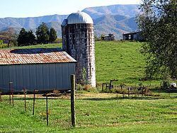 | ||
Destinations Roan Mountain State Park, Greeneville, Cherokee National Forest, Roan Mountain, Mountain City | ||
Greene county tennessee 3 travel destination video
Greene County is a county located on the eastern border of the U.S. state of Tennessee. As of the 2010 census, the population was 68,831. Its county seat is Greeneville, and the current county mayor is David Loy Crum (R).
Contents
- Greene county tennessee 3 travel destination video
- Map of Greene County TN USA
- Greene county tennessee 4 travel destination video
- History
- Geography
- Adjacent counties
- National protected areas
- State protected areas
- Other historic sites
- County Commission
- Demographics
- Education
- Hospitals
- City
- Towns
- Census designated place
- References
Map of Greene County, TN, USA
Greene County comprises the Greeneville, TN Micropolitan Statistical Area.
Greene county tennessee 4 travel destination video
History
Greene County developed from the "Nolichucky settlement," established by pioneer Jacob Brown on land leased in the early 1770s from the Cherokee people. The Nolichucky settlement was aligned with the Watauga settlement, centered in modern Elizabethton.
After the United States became independent, Greene County was formed in 1783 from the original Washington County, North Carolina, part of the former Washington District. The county is named for Major General Nathanael Greene (1742-1786), a major general in the Continental Army from Rhode Island. John Crockett, father of Davy Crockett, and his wife settled in the county near Limestone. Davy was born there in 1786. At the time, the area was part of the extra-legal state Franklin.
Greene County is the home of Tusculum College, the oldest college in Tennessee; the state's oldest Methodist congregation (the Ebenezer Methodist Church, near Chuckey), and the state's second oldest continuously cultivated farm (Elmwood Farm, part of the Earnest Farms Historic District). Revolutionary War veteran, and state legislator, Col. Joseph Hardin made Greene County his home for a period of time, serving as justice of the peace and as one of the original trustees of Tusculum (then Greeneville) College.
As with yeomen farmers in much of East Tennessee, those in Greene County were generally Unionist and opposed to secession on the eve of the Civil War. In Tennessee's Ordinance of Secession referendum on June 8, 1861, Greene Countians voted against secession by a vote of 2,691 to 744. Following the vote (the call for secession was passed statewide), the second session of the East Tennessee Convention convened in Greeneville. It called for a separate, Union-aligned state to be formed in East Tennessee.
A railroad bridge near Mosheim was among those destroyed by the East Tennessee bridge-burning conspiracy in November 1861. Several of the conspirators who had taken part in the burning of this bridge were later captured and executed by Confederate supporters, including Jacob Hensie, Henry Fry, Jacob and Henry Harmon, and noted local potter Alex Haun.
Geography
According to the U.S. Census Bureau, the county has a total area of 624 square miles (1,620 km2), of which 622 square miles (1,610 km2) is land and 2.0 square miles (5.2 km2) (0.3%) is water. Most of Greene County is located within the Ridge-and-Valley Appalachians, a range characterized by long, narrow ridges alternating with similarly-shaped valleys. Bays Mountain, a prominent ridge in this range, forms much of Greene's northern border with Hawkins County. The extreme southeastern part of Greene County is located within the Blue Ridge Mountains, specifically a subrange of the Blue Ridge known as the Bald Mountains. This range straddles Greene's border with North Carolina, and includes the county's two highest points: Gravel Knob, which rises to over 4,840 feet (1,480 m), and 4,844-foot (1,476 m) Camp Creek Bald (it's uncertain which is higher due to lack of an exact measurement for Gravel Knob's elevation).
Greene County is drained by the Nolichucky River, which traverses the southern half of the county. This river is impounded by Nolichucky Dam south of Greeneville, creating Davy Crockett Lake.
Adjacent counties
National protected areas
State protected areas
Other historic sites
County Commission
Members of the county commission are elected by geographic district. They are as follows:
Demographics
As of the census of 2000, there were 62,909 people, 25,756 households, and 18,132 families residing in the county. The population density was 101 people per square mile (39/km²). There were 28,116 housing units at an average density of 45 per square mile (17/km²). The racial makeup of the county was 96.42% White, 2.11% Black or African American, 0.18% Native American, 0.27% Asian, 0.02% Pacific Islander, 0.43% from other races, and 0.56% from two or more races. 1.02% of the population were Hispanic or Latino of any race.
There were 25,756 households out of which 29.20% had children under the age of 18 living with them, 55.70% were married couples living together, 10.80% had a female householder with no husband present, and 29.60% were non-families. 25.80% of all households were made up of individuals and 10.70% had someone living alone who was 65 years of age or older. The average household size was 2.38 and the average family size was 2.84.
In the county, the population was spread out with 22.20% under the age of 18, 8.10% from 18 to 24, 28.70% from 25 to 44, 26.10% from 45 to 64, and 14.80% who were 65 years of age or older. The median age was 39 years. For every 100 females there were 95.10 males. For every 100 females age 18 and over, there were 91.40 males.
The median income for a household in the county was $30,382, and the median income for a family was $36,889. Males had a median income of $26,331 versus $20,304 for females. The per capita income for the county was $15,746. About 11.20% of families and 14.50% of the population were below the poverty line, including 19.00% of those under age 18 and 16.70% of those age 65 or over.
Education
Public schools in Greene County school system include the following, with their enrollments for the 2007-2008 school year:
Public schools that are within Greene County but are part of the Greeneville City School System include:
Hospitals
Two hospitals are located in Greene County: Laughlin Memorial Hospital and Takoma Regional Hospital.