
Max. length 10 mi (16 km) Average depth 114 ft (35 m) Area 15.05 km² Length 16.1 km Shore length 77.2 km | Basin countries United States Surface area 3,720 acres (1,510 ha) Surface elevation 309 m Mean depth 35 m Catchment area 717.4 km² | |
 | ||
Location Linn County, Oregon,United States | ||
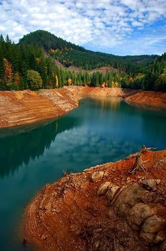
Green Peter Reservoir is a reservoir created by Green Peter Dam on the Middle Santiam River 11 miles (18 km) northeast of Sweet Home, Oregon, United States. The reservoir is approximately 10 miles (16 km) long and has a surface area of approximately 3,720 acres (1,510 ha) when full. The reservoir is used for hydropower, recreation, fish and wildlife habitat, flood risk management, water quality and irrigation.
Contents
Map of Green Peter Reservoir, Oregon 97329, USA
Recreation Areas
Whitcomb Creek Park is a 328-acre (133 ha) rustic park with 39 basic camp sites and a boat ramp. Whitcomb Creek Park also has a separate group camping area that holds up to 100 people.
Thistle Creek Boat Ramp is located on the north shore of the reservoir. It is open year round and the boat ramp was extended in 1999 allowing access to the reservoir at winter low pool.
Whitcomb Creek Park and Thistle Creek Boat Ramp are both operated by the Linn County Parks Department.