
Country United States Time zone Pacific (UTC-8) Elevation 164 m Population 9,052 (2013) Mayor Jim Gourley (D) | Incorporated 1893 Area code(s) 458 and 541 Zip code 97386 Local time Sunday 1:44 AM | |
 | ||
Weather 7°C, Wind NW at 11 km/h, 97% Humidity Area 14.89 km² (13.73 km² Land / 117 ha Water) | ||
9th sweet home oregon broker duo real estate
Sweet Home is a city in Linn County, Oregon, United States. The population was 8,925 at the 2010 census. According to the city, "Sweet Home is sometimes referred to as the 'Gateway to the Santiam Playground' due to its proximity to nearby lakes, rivers and the Cascade Mountains."
Contents
- 9th sweet home oregon broker duo real estate
- Map of Sweet Home OR USA
- History
- Geography
- Climate
- Demographics
- 2010 census
- Economy
- Annual cultural events
- Covered bridges
- Recreation
- Transportation
- Education
- Media
- Notable people
- References
Map of Sweet Home, OR, USA
History
Settlers first arrived in the Sweet Home Valley in the early 1850s. A community known as Buckhead developed near the mouth of Ames Creek and the South Santiam River. Buckhead was named after a saloon that featured a set of elk antlers on the gable end of its building. East of Buckhead, a community called Mossville developed with a store and post office. In 1874, the two communities merged to become one community called Sweet Home. In 1893, the city of Sweet Home was incorporated.
The Santiam Wagon Road, a toll road connecting the Willamette Valley with central Oregon, was opened in 1865. The road extended from the Sweet Home Valley across the Santiam Pass in the Cascades to Camp Polk near Sisters. The Santiam Wagon Road was a vital means of supplying livestock and goods from western Oregon to central Oregon and transporting wool from east of the Cascades back to Willamette Valley woolen mills. Competition with railroads that extended south from the Columbia River into central Oregon and the newly opened McKenzie Pass Highway made the wagon road obsolete by the late 1930s. U.S. Route 20 was constructed across much of the same route as the Santiam Wagon Road.
Sweet Home experienced significant growth during the 1940s due to the demand for timber from local forests. Further growth occurred when construction began on nearby Green Peter Dam in 1962 and continued as construction began on Foster Dam in 1966.
During the 1980s, Sweet Home experienced a number of sawmill and plywood mill closures due to economic cycles, increased competition, increased productivity, and logging restrictions placed on nearby forests resulting from environmental concerns for endangered species. In response, community members sought out other economic development opportunities such as the Oregon Jamboree country music and camping festival.
Geography
According to the United States Census Bureau, the city has a total area of 5.75 square miles (14.89 km2), of which 5.30 square miles (13.73 km2) is land and 0.45 square miles (1.17 km2) is water.
The intersection Oregon Route 228 and U.S. Route 20 occurs at the Western end of Sweet Home.
The South Santiam River flows from Foster Reservoir along the northern city limits of Sweet Home. Ames Creek and Wiley Creek flow into the South Santiam River within the city limits.
Sweet Home is built on a prehistoric petrified forest. In addition to fossil wood, the area includes a variety of agate, jasper, crystals and minerals.
Climate
This region experiences warm (but not hot) and dry summers, with no average monthly temperatures above 71.6 °F (22.0 °C). According to the Köppen Climate Classification system, Sweet Home has a warm-summer Mediterranean climate, abbreviated "Csb" on climate maps.
Demographics
The median income for a household in the city was $37,182; 20.0% of persons were below the poverty line.
2010 census
As of the census of 2010, there were 8,925 people, 3,440 households, and 2,315 families residing in the city. The population density was 1,684.0 inhabitants per square mile (650.2/km2). There were 3,768 housing units at an average density of 710.9 per square mile (274.5/km2). The racial makeup of the city was 93.3% White, 0.3% African American, 1.3% Native American, 0.8% Asian, 0.1% Pacific Islander, 1.1% from other races, and 3.0% from two or more races. Hispanic or Latino of any race were 4.7% of the population.
There were 3,440 households of which 33.7% had children under the age of 18 living with them, 47.5% were married couples living together, 13.9% had a female householder with no husband present, 5.9% had a male householder with no wife present, and 32.7% were non-families. 25.7% of all households were made up of individuals and 11.4% had someone living alone who was 65 years of age or older. The average household size was 2.57 and the average family size was 3.05.
The median age in the city was 39.6 years. 25.7% of residents were under the age of 18; 7.6% were between the ages of 18 and 24; 22.3% were from 25 to 44; 27.5% were from 45 to 64; and 16.7% were 65 years of age or older. The gender makeup of the city was 49.6% male and 50.4% female.
Economy
Major employers in Sweet Home include Ti Squared Technologies, a titanium foundry; White's Electronics, a metal detector manufacturer; HEVI-Shot, a manufacturer of shotshell ammunition; Cascade Timber Consulting, a timber investment management organization; Weyerhaeuser; the United States Forest Service and the Sweet Home School District.
Annual cultural events
Covered bridges
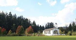
The Weddle Covered Bridge, relocated from Thomas Creek near Scio, crosses Ames Creek at Sankey Park in Sweet Home. The Crawfordsville Covered Bridge spans the Calapooia River 8 miles (13 km) southwest of Sweet Home and the Short Covered Bridge crosses the South Santiam River 12 miles (19 km) east of Sweet Home.
Recreation
Sweet Home has seven city parks. Nearby recreation opportunities include boating, hunting, fishing, hiking, white-water sports, camping and gold panning.
Foster Reservoir on the South Santiam River has boat ramps and a year-round marina while Green Peter Reservoir provides two improved boat ramps. The South Santiam River offers salmon and steelhead fishing while Quartzville Creek is recognized for Class 4 and Class 5 kayaking and gold panning opportunities.
Nearby hiking trails include Horse Rock Ridge, Soda Creek Falls Trail at Cascadia State Park and numerous trails throughout the Willamette National Forest. The Menagerie Wilderness provides rock climbing challenges.
An 18-hole golf course, Mallard Creek Golf Club, is 11 miles (18 km) northwest of Sweet Home. The nearest ski resort, Hoo Doo Ski Bowl, is 52 miles (84 km) to the east, near Santiam Pass.
Sweet Home has also been featured on the Travel Channel program "Cash and Treasures" for an abundant petrified wood find at Holleywood Ranch between Sweet Home and Holley, Oregon.
Transportation
Sweet Home receives public transportation service from Linn Shuttle.
Education
Sweet Home is served by the Sweet Home School District. The district includes Sweet Home High School, a junior high school and four elementary schools. The district covers Sweet Home, Cascadia, Crawfordsville, Holley, Liberty, Pleasant Valley and other surrounding communities.
Linn–Benton Community College operates a branch campus in Sweet Home.
Media
The New Era newspaper is published weekly. The daily Albany Democrat-Herald also serves the city.