
Population 24,211 Civil parish Great Sankey Local time Thursday 12:23 PM | OS grid reference SJ575885 Dialling code 01925 | |
 | ||
Weather 11°C, Wind W at 26 km/h, 66% Humidity | ||
Great Sankey is a civil parish and suburb of Warrington, Cheshire, England. It is 2 miles (3.2 km) west of Warrington town centre and has a population of 24,211.
Contents
- Map of Great Sankey UK
- History
- Governance
- Religion
- Demographics
- Population and ethnicity
- Housing and social situation
- Affluence
- Employment and education
- Education
- Transport
- References
Map of Great Sankey, UK
History
The village of Great Sankey was originally a chapelry in Prescot parish in Lancashire. It became formally a separate civil parish in 1866, and it was transferred to Cheshire in 1974. There was industrial growth along the banks of the Sankey Canal at Sankey Bridges during the 19th century but otherwise the area was rural. RAF Burtonwood was built on the outskirts in 1939. Since then, the area transformed into a residential suburb for Warrington New Town.
Governance
Great Sankey forms part of Warrington South constituency of the United Kingdom Parliament. It is also divided into three council wards for the election of councillors to Warrington Borough Council: Great Sankey North, Great Sankey South and Whittle Hall. Great Sankey North has two Liberal Democrat councillors, Great Sankey South has three Liberal Democrat councillors and Whittle Hall has one Liberal Democrat and one Labour councillor.
The civil parish is governed by a parish council consisting of fifteen elected members.
Religion
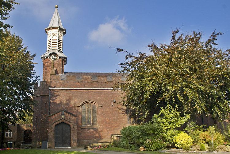
The Parish Church of the Church of England is in the Diocese of Liverpool and dedicated to St. Mary. The nearest Roman Catholic church is in Penketh (St. Joseph's). Similarly, the nearest Methodist Church is also in Penketh.
Demographics
Data are based on official 2001 census figures, and also on those of Great Sankey North and Great Sankey South wards.
Population and ethnicity
The district of Great Sankey has a total population of 16,960 residents, of which 49.5% are male and 50.5% are female. The average age of the population at the 2001 census was 24.3 years. Of the 16,960 residents, 98.05% describe their racial origin as white. Other major majorities are mixed (0.55%), black (0.15%) and Asian origin (0.75%). Other race accounts for 0.50%.
Housing and social situation
At the last count (2001), there were 6,381 households in Great Sankey, of which 87.10% are owner occupied, 9.55% are social accommodation, 2.70% are rented from private landlords and 0.70% have residents who live rent free. The average house price is £136,409. Of the 6,381 houses, 2.80% are classed as overcrowded. The population density is 43.75 residents per hectare. The majority of residents describe Sankey as a "comfortably well-off" area. On the Index of Multiple Deprivation, Great Sankey was described as one of the most affluent areas of Warrington.
Affluence
Great Sankey and neighboring Penketh are amongst the most affluent parts of Warrington, north of the River Mersey. Its key position near the M62 motorway links, and being in between the cities of Liverpool and Manchester, make it a popular place to live. Relatively unaffected by the 2008 financial bank crisis, unlike other parts of Warrington, the area has continued to see the development of Chapelford Urban Village, with new restaurants and shopping facilities near by. The development on the former Burtonwood Airbase (now known as Omega) also continue.
Employment and education
66.20% of all resident in the Great Sankey wards are employed while unemployment stands at 2.25%. Of the population 2.50% of residents are students in full-time education. 26.44% of residents are economically inactive (due to retirement, disability or acting as a full-time carer). In terms of education, 24.05% of residents have no qualifications whatsoever (mainly down to dropping out of school early or failing end of school examinations). 49.70% of residents only have level one or two qualifications (at least 1 GCSE pass (A*-G) or equivalent), and 18.25% have at least level three qualifications (at least 2 A-levels (A-E) or 4 AS levels (A-E) or equivalent).
Education
The secondary school is Great Sankey High School. This site also contains facilities for its sixth form under the name of Barrow Hall College. Nine primary schools (Barrow Hall, St Philips, Park Road, Old Hall, St Joseph's, Chapelford Village, St James, Callands and Burtonwood) serve Great Sankey.
Sycamore Lane Primary School closed in early 2013, with staff and pupils relocating to Chapelford Village Primary School.
Transport
Sankey railway station is on the Liverpool to Manchester line and served by an hourly service of stopping trains run by Northern. Bus services link Sankey, Whittle Hall and Sankey Bridges with Warrington Town Centre, the retail and cinema centre at Westbrook and the Gemini Retail Park, but there are no longer any regular services to other towns such as St Helens, Liverpool or Prescot Great Sankey is on the A57 road linking Warrington with the M62 motorway at junction 7. The nearest airport is Liverpool John Lennon Airport.