
Population 8,699 (2001) Civil parish Penketh Local time Sunday 9:09 AM | OS grid reference SJ595891 Dialling code 01925 | |
 | ||
Weather 7°C, Wind E at 8 km/h, 53% Humidity | ||
Gangnam style head teacher penketh high school
Penketh is a civil parish and suburb of Warrington, Cheshire, England. It is located about 3 miles (4.8 km) west of Warrington town centre. It has a population of 8,699.
Contents
- Gangnam style head teacher penketh high school
- Map of Penketh UK
- Penketh eye october edition 2016
- History
- Government
- Industry
- Churches
- Schools
- Pubs
- Transport
- Demographics
- Race and gender
- Housing demographics
- References
Map of Penketh, UK
The name is derived from two Brythonic words: *penno- (head) and *kēto- (trees) (Welsh pen coed); suggesting that the parish, at one time was on the outskirts of a forest. The emblem/badge of Penketh is three kingfishers.
Penketh eye october edition 2016
History
Penketh was originally part of Prescot parish but became a chapelry and then a separate parish. It grew due to the crossing over the Mersey at Fiddlers Ferry and the building of the Sankey Canal. The area was mainly rural and agricultural until well into the 20th century, though a tannery and boatyard were established in the 19th century.
The last 50 years has seen the area transformed into a large residential suburb.
Government
Historically within Lancashire, the parish has a Parish Council and is a ward of Warrington Borough. It is in Warrington South constituency of the United Kingdom Parliament. Until the major local government reorganisation of 1974, Penketh was part of Warrington Rural District.
Industry
The former tannery and boatyard were the only major industries in Penketh. Fiddlers Ferry Power Station dominates Penketh, though it is in Cuerdley parish.
Churches
There is a parish church (St Paul's, Church of England), and a Catholic church (St Joseph's). There is a strong nonconformist tradition as exemplified by the Methodist chapel in Chapel Road. The Quakers were well represented at one time; the Meeting House was the present village hall on Meeting Lane.
Schools
The secondary school is Penketh High School. The primary schools in the area are Penketh Community Primary School (a feeder school for Penketh High School), Penketh South Primary School, St Joseph's Catholic Primary School and St Vincent's Catholic Primary School.
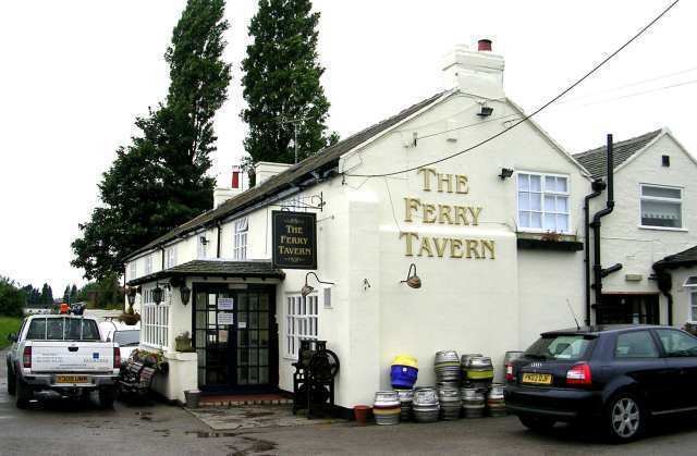
Pubs
Pubs in the area include the Ferry Tavern, the Crown & Cushion, the Sportsman's Arms and the Red Lion
Transport
Railway stations in the area include local services from Sankey for Penketh on the Liverpool to Manchester Line (with express services along this route available from Warrington Central), as well as Warrington Bank Quay on the West Coast Main Line. Frequent buses link Penketh with Warrington town centre: it is the terminus for Warrington Borough Transport buses (routes 30, 30B, 31 and 32A), and the north of Penketh is also served by Warrington Borough Transport routes 14 and 15. Arriva inter-urban services also serve the main road through Penketh, heading towards Widnes and Runcorn (route 110) and to Huyton and Liverpool (route 7). Penketh is on the A562 road linking Warrington with the Silver Jubilee Bridge. The nearest airports are Liverpool and Manchester.