
Sovereign state United Kingdom Postcode district NR21 Local time Thursday 12:19 PM UK parliament constituency Broadland | ||
 | ||
Weather 12°C, Wind W at 40 km/h, 57% Humidity | ||
Great Ryburgh is a village in the English county of Norfolk. Administratively the village is within the civil parish of Ryburgh (where the population is included) along with Little Ryburgh, in the district of North Norfolk.
Map of Great Ryburgh, Fakenham, UK
It is located about two miles south-east of the market town of Fakenham. The River Wensum flows through the village. The village has a large maltings which has been producing malt on a traditional malting floor for two centuries. The village and maltings were formerly served by Ryburgh station on the Great Eastern Railway branch from Wymondham and East Dereham to Fakenham and Wells-next-the-Sea. This line is proposed for restoration, as far as Fakenham, by the Mid-Norfolk Railway.
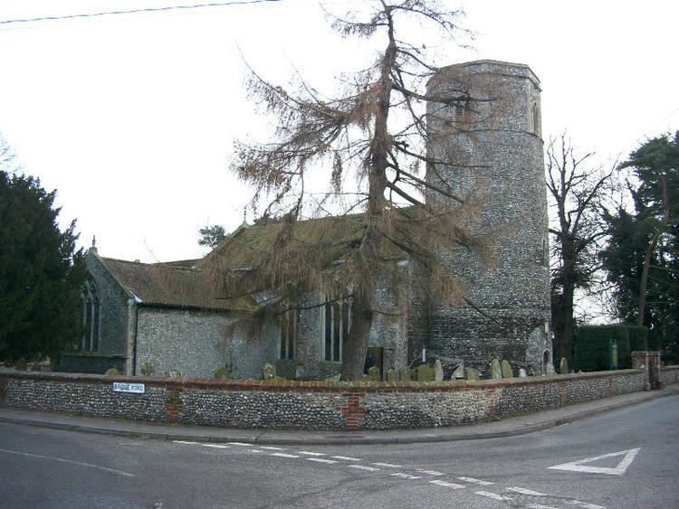
The church of Great Ryburgh St. Andrew is one of 124 existing round-tower churches in Norfolk.
The Boar Inn is located in Great Ryburgh and is a traditional English country inn, with low-beamed ceilings and an inglenook fireplace in the bar.
An Anglo-Saxon cemetery was discovered in 2016 by an Museum of London Archaeology excavation that was largely funded by Historic England. The waterlogged conditions of the site led to the remarkable preservation of burials including 6 plank-lined graves and 81 hollowed tree-trunk coffins dating from the 7th-9th century AD. The evidence is this may have been a community of early Christians, including a timber structure thought to be a church or chapel