
 | ||
The great glen ways and caledonian canal
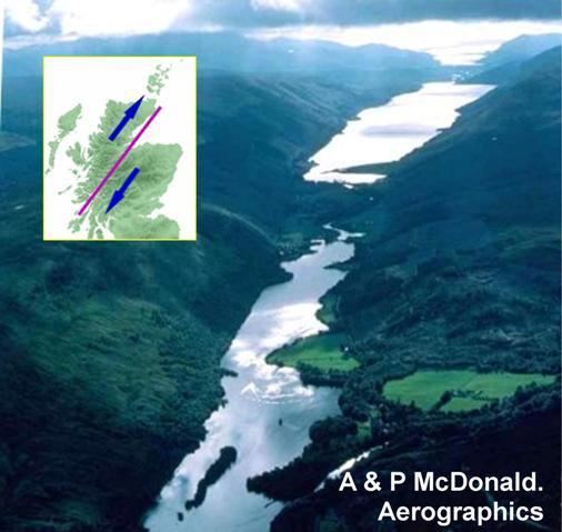
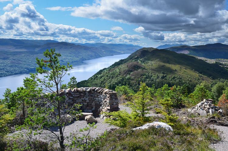
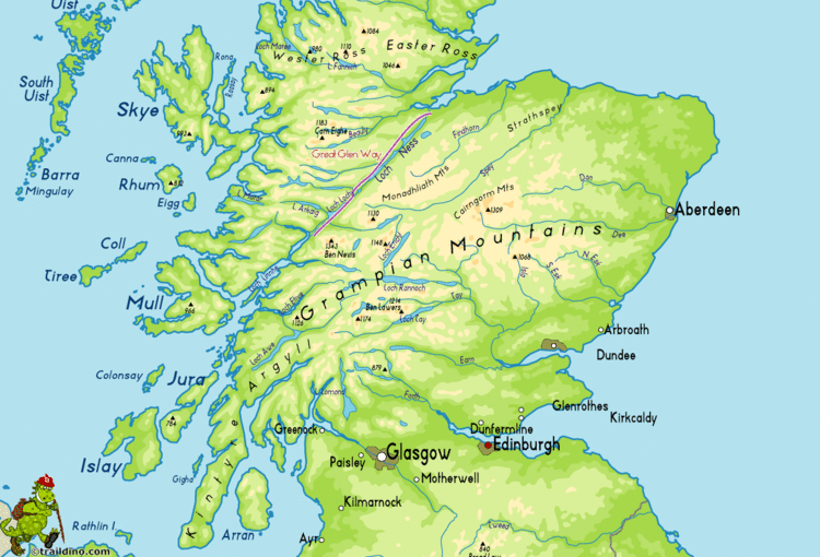
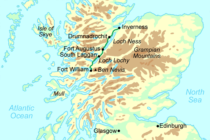
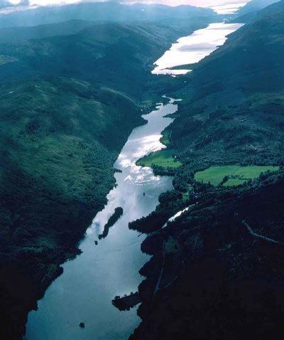
The Great Glen (Scottish Gaelic: An Gleann Mòr), also known as Glen Albyn (from the Scottish Gaelic Gleann Albainn "Glen of Scotland") or Glen More (from the Scottish Gaelic An Gleann Mòr) is a long and straight glen in Scotland running for 62 miles (100 km) from Inverness on the edge of Moray Firth, to Fort William at the head of Loch Linnhe.
Contents
The Great Glen follows a large geological fault known as the Great Glen Fault. It bisects the Scottish Highlands into the Grampian Mountains to the southeast and the Northwest Highlands to the northwest.
The glen is a natural travelling route in the Highlands of Scotland, which is used by both the Caledonian Canal and the A82 road, which link the city of Inverness on the northeast coast with Fort William on the west coast. The Invergarry and Fort Augustus Railway was built in 1896 from the southern end of the glen to the southern end of Loch Ness, but was never extended to Inverness. The railway closed in 1947.
A recent development was the opening of a long-distance route for cyclists, canoeist and walkers. Called the Great Glen Way, it links Fort William to Inverness. Officially opened on 30 April 2002 by HRH The Earl of Inverness, the route is a series of footpaths, forestry tracks, canal paths and occasional stretches of road.
Its strategic importance in controlling the Highland Scottish clans, particularly around the time of the Jacobite uprisings of the 18th century, is recognised by the presence of the towns of Fort William in the south, Fort Augustus in the middle of the Glen, and Fort George, just to the north of Inverness.
Much of the glen is taken up with a series of lochs, with rivers connecting them. The Caledonian Canal also uses the lochs as part of the route, but the rivers are not navigable.
From northeast to southwest, the natural water features along the Great Glen are:
The watershed, or water-divide, lies between Loch Oich and Loch Lochy. Loch Linnhe to the south of Fort William is a sea-loch into which both the River Lochy and Caledonian Canal emerge. At the north end, the River Ness empties into the Moray Firth.
Seismic activity
Although earthquakes in the vicinity of the Great Glen Fault tend to be minor, seismic activity is a consideration in the design of infrastructure. For example, the Kessock Bridge includes seismic buffers.