 | ||
Similar King Edward Mine, Tehidy, East Pool mine, Cornish Mines and Engines, Poldark Mine | ||
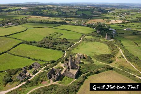
Great flat lode trail
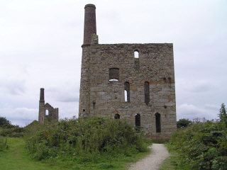
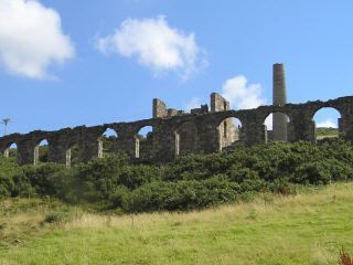
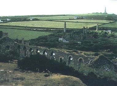
The Great Flat Lode is a mineral-bearing body of rock under the southern granite slopes of Carn Brea south of Camborne in west Cornwall, England, UK.
Contents
History of cornish mining the time tunnel great flat lode
Mining
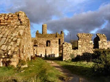
The Great Flat Lode lies under the southern granite slopes of Carn Brae and so named because the tin-bearing rock was at an unusually shallow gradient of about 10 degrees to the horizontal. In other parts of Cornwall mineral bearing lodes lie at between 60 and 90 degrees to the horizontal. "Lode" is a mining term for a mineral vein. Its small gradient allowed for optimal location of the mines. The minerals were accessed by the South Condurrow Mine (later renamed King Edward Mine and used by the Camborne School of Mines), Wheal Grenville, South Wheal Frances Mine and the Bassett Mines. The mines were started to obtain copper ore but at greater depths tin was obtained.
Many of the mines amalgamated and continued production until the First World War.
Trail
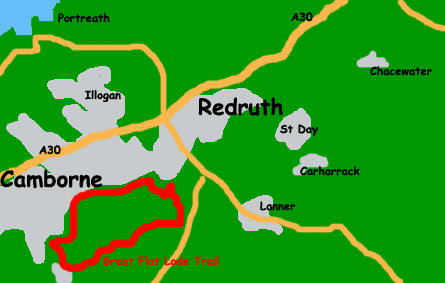
The Great Flat Lode Trail, a 12 km (7.5 mi) long circular trail around |Carn Brea 50.22179°N 5.24673°W / 50.22179; -5.24673 is one of Cornwall's Mineral Tramway Trails.