
Highest point 2,590 m (8,500 ft) Months July to September | Trail difficulty Strenuous Length 1.2 million m | |
 | ||
Lowest point Old Fort Point trailhead, 1,055 m (3,461 ft) Similar Continental Divide Trail, Banff National Park, Continental Divide of the Ameri, Jasper National Park, Skyline Trail | ||
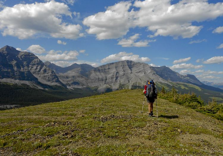
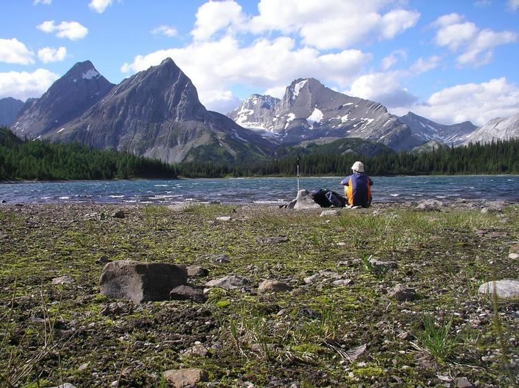
Great divide trail canada kananaskis to the rockwall trail by trekkingthewest com
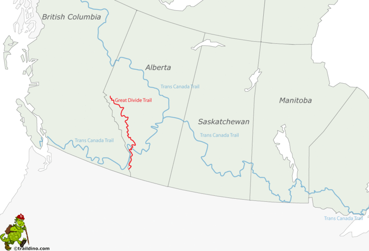
The Great Divide Trail (GDT), is a wilderness hiking trail in the Canadian Rockies. The trail closely follows the Great Divide between Alberta and British Columbia, crossing the divide no fewer than 30 times. It begins in Waterton Lakes National Park at the Canada-US border (where it connects with the Continental Divide Trail) and ends in Kakwa Provincial Park north of Jasper National Park. The Great Divide Trail is 1,200 km long and ranges in elevation from 1,055 m (3,461 ft) at Old Fort Point trailhead near Jasper to 2,590 m (8,497 ft) at an unnamed pass above Michele Lakes just south of the White Goat Wilderness Area.
Contents
- Great divide trail canada kananaskis to the rockwall trail by trekkingthewest com
- straddling the divide the great divide trail dave hockey
- History
- Route
- References
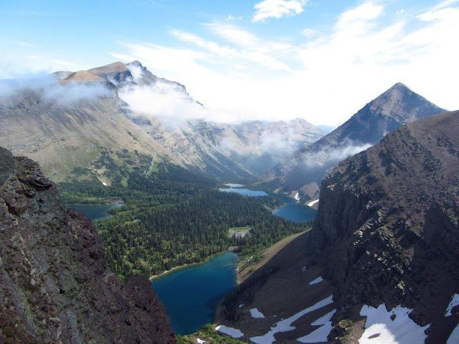
straddling the divide the great divide trail dave hockey
History
The first record of the Great Divide Trail appears in 1966 when the Girl Guides of Canada proposed the idea of a trail running the length of the BC–Alberta border through the Rocky Mountains. In 1970, Jim Thorsell developed the first-ever GDT guide: the "Provisional Trail Guide and Map for the Proposed Great Divide Trail" and the national park service approved the project with the objective of completing the GDT by 1975. However, five years later Parks Canada stalled its planning process altogether, citing inadequate trail planning methodology and unresolved overuse issues.
Outside of the National Parks, the route south of Palliser Pass was originally mapped in 1974 by six University of Calgary students with support from the Alberta Wilderness Association and the Federal Opportunities for Youth Program. Mary Jane Cox, Jenny Feick, Chris Hart, Dave Higgins, Cliff White, and Dave Zevick surveyed an estimated 4,800 km along the proposed GDT route outside of the National Parks. Cliff White was the project coordinator and used the data from the project as the basis of an undergraduate thesis. They founded the Great Divide Trail Association and began trail construction in the summer of 1976. But by the mid-1980s, long after Parks Canada had abandoned the idea, provincial support waned, the Great Divide Trail Association faded from existence and the concept of the GDT nearly disappeared.
But in 2000, Dustin Lynx released his guidebook "Hiking Canada's Great Divide Trail", breathing new life into the GDT. And in 2004, a group known as the Friends of the Great Divide Trail began to work on the GDT once again, dedicated to maintaining the original section of the GDT running through unprotected Alberta Crown Forest Reserve lands, from North Fork Pass to Fording River Pass, that was constructed in the 1970s and 80s. In April 2013, the Friends of the Great Divide Trail re-activated the Great Divide Trail Association, a Canadian not-for-profit corporation headquartered in Calgary, Alberta, dedicated to maintaining and protecting the GDT.
Route
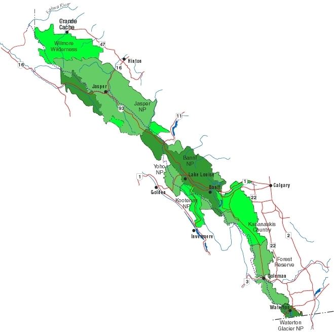
While the Great Divide Trail is a recognized hiking trail, it is not officially recognized by Parks Canada and therefore is not signed and not always even an actual trail, sometimes merely a wilderness route. The GDT passes through five National Parks: Waterton Lakes, Banff, Kootenay, Yoho and Jasper; seven Provincial Parks: Akamina-Kishinena, Elk Lakes, Peter Lougheed, Height of the Rockies, Mount Assiniboine, Mount Robson and Kakwa; four wilderness areas: Beehive Natural Area, Kananaskis Country, White Goat Wilderness Area and Willmore Wilderness Area; and five forest districts: Castle, Bow/Crow, Cranbrook, Golden and Robson Valley.

The Great Divide Mountain Bike Route is the mountain biking version that parallels the Great Divide Trail. Occasionally they will intersect and share sections.
The Great Divide is the major hydrological divide of North America. Along the GDT, the Great Divide separates water flowing into the Pacific Ocean to the west (via the Columbia River) from Hudson Bay (via the North Saskatchewan River) and the Arctic Ocean (via the Athabasca River) to the east.