
OS grid reference SD5797 Sovereign state United Kingdom Dialling code 01539 | Civil parish Grayrigg Local time Thursday 6:21 AM | |
 | ||
Population 242 (2011. Includes Lambrigg) Weather 8°C, Wind W at 29 km/h, 86% Humidity | ||
Grayrigg is a small village and civil parish in the South Lakeland district of Cumbria, England. It lies on undulated and partly mountainous land, 4.9 miles (8 km) north east of Kendal, on the north side of the West Coast Main Line, and west side of the M6 motorway.
Contents
Map of Grayrigg, Kendal, UK
History
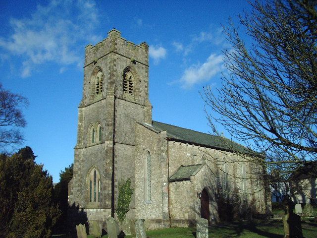
Historically a part of Westmorland, Grayrigg and its surrounding area have provided evidence of an ancient Roman camp. During the Middle Ages Grayrigg formed a chapelry and township centred on the chapel dedicated to St John the Evangelist, which is still in use.
Railway accidents
Grayrigg's 20th and 21st century history is marked by two high-profile major train crashes.
On 18 May 1947, a 13-carriage Glasgow to London express failed to stop at the signals for Lambrigg Crossing and collided with a locomotive with 33 people injured, three seriously.
On 23 February 2007, Lambrigg Crossovers (54.358507,-2.655958), south of Grayrigg was the site of the Grayrigg derailment, a fatal derailment involving a Virgin Trains service from London Euston to Glasgow Central.